-
I'm using CoastSat to collect ~1 year of images from L8 and S2. About 20 images are downloaded from L8 and about 40 from S2.
After mapping the reference shoreline the code outputs:
Mapping …
NO645 updated
4 years ago
-
Hello Vos,
I found there is a problem about setting threshold of maximum cloud cover.
I was setting the threshold of 0.0. The reason why I was setting this threshold because I want to reduce…
-
Hi KILLIAN,
This is Meghana, I have been running this coastsat with my polygon. After plotting the reference shoreline, rest of the shorelines are not mapped with the shoreline(blackline). But other …
-
If a channel network mask is provided for which the outlet links are not connected via an ocean or other waterbody, the pruning performed by `prune_network()` either removes too much of the network or…
-
Dear Kilian,
from time to time it happens that I get an error message "too many indices for array" when I try to digitize a reference shoreline. This is the output which is following after I close…
-
Hello Killan,
I started using coastsat as a part of my dissertation. I have successfully completed the example on Narra beach. After changing the coordinates and site name of the example, the code…
-
Hello, I plan to re-train the classer to seperate two classes ( ice and water ) in glacier terminate position.
So I change the code and related function and I want make a label that need just two c…
-
Hi Kilian,
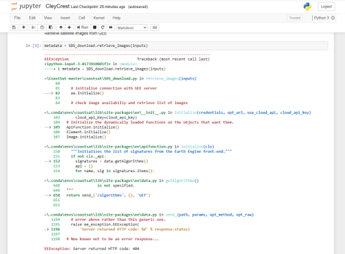
I keep getting this message today:

I've tried scripts that used to …
-
When running the code everything works except for the shoreline change analysis. I can select shorelines, view all of the created shorelines, and draw transects for them, but the cross distance is giv…
-
Hi,
This has been a frequent problem of mine. Whenever i press the right arrow which says keep
![wrong narra](https://user-images.githubusercontent.com/60566848/73605838-46235b80-45de-11ea-8663-6b…
Ziene updated
4 years ago