 bbest
commented
2 years ago
bbest
commented
2 years ago Profiling
- SWFSC folks made pretty maps with commercial s/w Surfer | Golden Software Support:

- How?
- across survey segments on only or any place?
Open bbest opened 2 years ago
bbest
commented
2 years ago bbest
commented
2 years ago min(date)) on x axismin(date)) on x axisbbest
commented
2 years ago See knitted Rmarkdown html with first read of data here:
https://calcofi.github.io/scripts/oceano-bottle.html
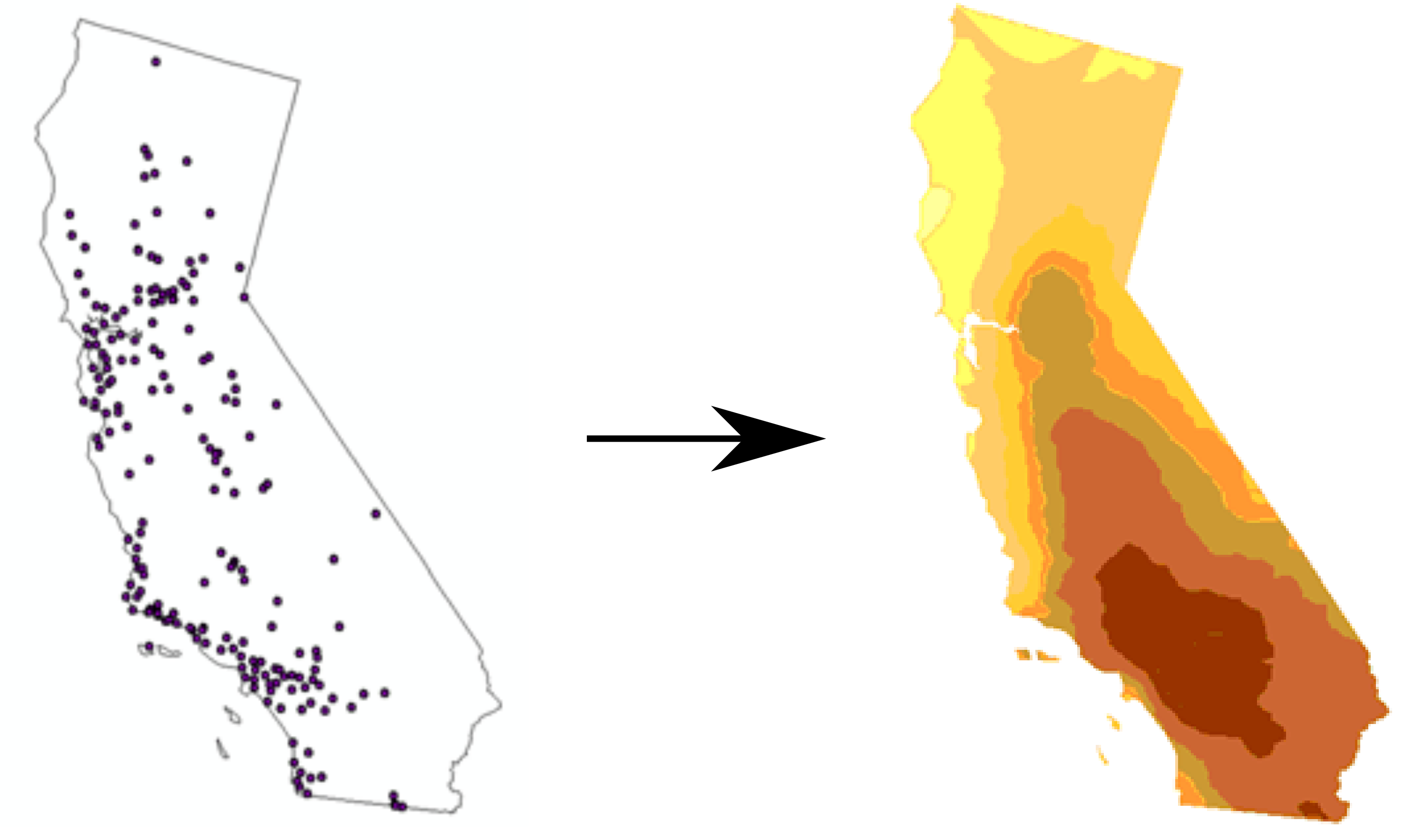
Let's consider the following example of CalCOFI survey tracks and wanting to extract information for an Area of Interest (AOI) for some management purpose:
https://shiny.ecoquants.com/calcofi/

Function to generate basic statistics (avg, min, max, stdev, hi90, lo10) given some parameters:
aoi: area of interest, as well known text (sf::st_text()) for eventually using in an API function modedate_beg: filter by start datedate_end: filter by end datedate_step: some notion of summarizing by annual / seasonal / quarterlydepth_min: filter by depth from surface (which direction +/-?)depth_max: filter by depth from surface (which direction +/-?)stats: a vector of functions as strings like: mean, min, max, stdev, hi90, lo10
You can quickly read this noaa-onms/onmsR:sanctuaries.geojson to pull Channel Islands as an example AOI with the following R code:
sanctuaries_geo <- "https://github.com/noaa-onms/onmsR/raw/12a87dfd4b90f2e3009ccb4913315fb2df7afddc/data-raw/sanctuaries.geojson"

cinms_ply <- sf:st_read(sanctuaries_geo) %>%
  dplyr::filter(nms == "CINMS")

cinms_txt <- sf::st_text(cinms_ply$geometry)Lots of geostatistical methods here:
IDW: inverse distance weightingkrigingReferences:
bbest
commented
2 years ago @cdobbelaere,
You can use oceano-bottle.Rmd and set path to Google Drive folder calcofi - Google Drive where it's sync'd to your local machine (using Download - Google Drive)
bbest
commented
2 years ago See #3 for more AOIs

aoi)idw()orkrige()and extract from surfaceread_bottle()incalcofi4rBackground
Appendix 1: CalCOFI Data Inventory 2021 - Google Sheets: