 govvin
commented
6 years ago
govvin
commented
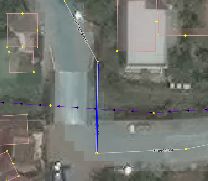
6 years ago Example of task with a mis-aligned bridge, as seen from aerial imagery, and detected by data analysis.
Closed govvin closed 6 years ago
govvin
commented
6 years ago Example of task with a mis-aligned bridge, as seen from aerial imagery, and detected by data analysis.
 ralleon
commented
6 years ago
ralleon
commented
6 years ago 
I tried to find fault/misaligned imagery with extensive observations in this area, but Bing (though cloudy in some parts) is very well aligned with Strava within this boxed imagery. I cannot find any significant anomaly. Good works on Bing (in this boxed area), unlike Digital Globe which have many distorted/stretched images found.
Boundary: Generally from upper Quezon City/Kalookan (on the North); On the East up to Batasang Pambansa in Quezon City, left of Marikina River up down to Taguig (lower righ corner), but up to NAIA runway only on the South.
This will save a lot of time on workflow (in fact I don't recommend aligning and interpreting partial GPS data, nor individually interpret Strava for localized alignment). I HIGHLY RECOMMEND that we should just simply align all OSM data exclusively on Bing within the said boundary, as well as align all other imagery (Mapbox, Digital Globe, ESRI on Bing) for the latest map feature update in the area.
The effort on this particular project should focus on establishing accurate offsets on IODb for Mapbox, Digital Globe, ESRI referenced to Bing (on its default Zero,Zero offset) for ease of tracing and realigning streets and adding new roads.
ralleon
commented
6 years ago 
govvin
commented
6 years ago Determining offsets, and recording them on IODb is a secondary goal @ralleon
govvin
commented
6 years ago Take advantage of AI with Strava's iD Slide, which looks very helpful for major roads, but must be used with caution:
Use the following for the Custom URL Utilsplugin2: https://strava.github.io/iD/#background=Bing&map=19.00/{#lon}/{#lat}
govvin
commented
6 years ago This issue was moved to KaartGroup/Philippines#9
govvin
commented
6 years ago Grab's OpenStreetMap data team has been in touch, and is co-ordinating their effort to identifying missing roads, and improving road geometry in Metro Manila. They've also adopted the use of the Imagery Offset Database to maintain mapping consistency across the mapping community.

Issue
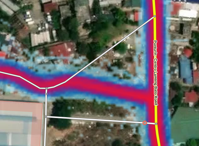
Based on Kaart GIS analysis, the Philippine road network data has positional errors (~3-17m) when compared to existing track logs (OpenStreetMap and Strava), and may also include incorrect topology that does not match aerial imagery.
To Do
Proposed road realignment strategy
Coverage
Guidelines
Data Sources
Validation and Error Detection
The contributors will visually check for errors together with using JOSM validation warnings prior to committing the changeset.
In addition, the contributors will review their work in accordance with the task guidelines including the OSM Wiki and LearnOSM validation conventions.
Contributors
The project is limited to OpenStreetMap contributors adept in JOSM, with advanced mapping skills.