 captainblaffer
commented
9 years ago
captainblaffer
commented
9 years ago Sounds like you need to press the toggle texture button on the map?
Closed Raspu86 closed 9 years ago
captainblaffer
commented
9 years ago Sounds like you need to press the toggle texture button on the map?
 Raspu86
commented
9 years ago
Raspu86
commented
9 years ago Nope, heights, contour lines, forests, streets were a lot more visible/stronger before.
captainblaffer
commented
9 years ago When I click that button the map will look just like the one in your picture. White with everything you explain very clearly visible
 KoffeinFlummi
commented
9 years ago
KoffeinFlummi
commented
9 years ago Better visible heights, contour lines, forests, streets, etc. Where did they go? We had them in BWA3 Realism once.
I don't think we did. Maybe you're thinking of the Navipad?
Raspu86
commented
9 years ago That's how it looks like right now: http://i.imgur.com/uSGjVmN.jpg
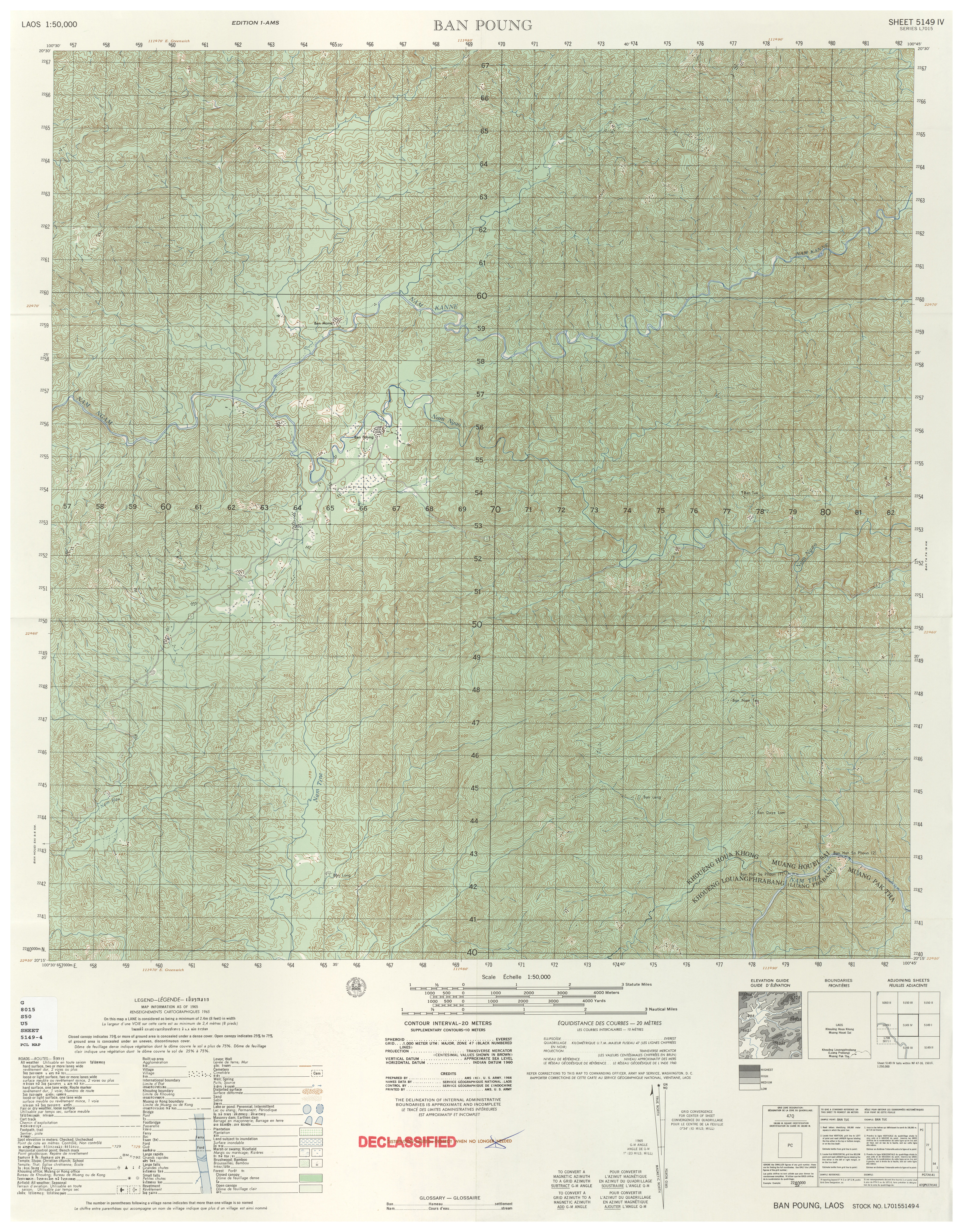
That's how it could look like: http://www.lib.utexas.edu/maps/topo/former_yugoslavia/krk-croatia-50k-2185iii-1995.pd http://www.lib.utexas.edu/maps/topo/laos/txu-pclmaps-oclc-743384338-ban-poung.jpg http://www.lib.utexas.edu/maps/topo/former_yugoslavia/banovici-bosnia_and_herzegovina-50k-2783i-1996.pdf
 jonpas
commented
9 years ago
jonpas
commented
9 years ago I suggest you check out: http://www.armaholic.com/page.php?id=26364
Raspu86
commented
9 years ago Turns out you can achieve a lot more realistic and lot more readable map pretty easily. So here we go
http://i.imgur.com/J0FmUpi.jpg http://i.imgur.com/uK4Oezm.jpg
jonpas
commented
9 years ago I do like contour interval dialog.
 Legolasindar
commented
9 years ago
Legolasindar
commented
9 years ago Personally I like to see is the elimination of gray squares that replace those buildings. It is very difficult sometimes, understand that building on the map viewing, if you can have 2 levels, if you have a stone wall or a fence, if a building and nothing else. The other day, for example, had to identify a football on the map, and it was impossible because the field appeared on the map as a gray rectangle, not the satellite image. This should include a button to toggle the gray squares. Or just not include them. I understand that actual maps are similar, but they also have available satellite images.
Better visible heights, contour lines, forests, streets, etc. Where did they go? We had them in BWA3 Realism once. It would be nice to have something like this again: http://i.imgur.com/ibJPWWl.jpg