 ThorTheDestroyer
commented
4 years ago
ThorTheDestroyer
commented
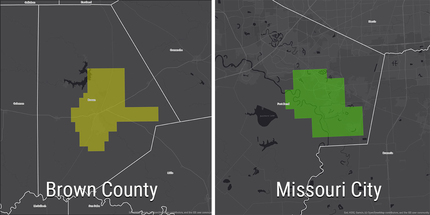
4 years ago title: New USGS Lower Colorado San Bernard 2018 Lidar Data Release author: Joey Thomas, StratMap layout: news-article.njk mainimage: https://s3.amazonaws.com/data.tnris.org/46b000dd-83b2-4701-b5c6-3f6e18cedccf/assets/34a0cde1-d679-411c-8ced-973143b93d26.jpg thumbnail: https://tnris-org-static.s3.amazonaws.com/images/brown_missouri_th.jpg thumbalt: A thumbnail for USGS 2018 Lidar Projects abstract: A collaborative initiative to capture high-quality Lidar data for portions of west south central Texas.
The Texas Natural Resources Information System (TNRIS) is pleased to announce the release of about 17,942 square miles of recently acquired, high resolution lidar data over 26 counties in south central Texas. Aerial collection took place during the 2018 leaf-off season in Texas.
The project was funded by a federal consortium of partners to support the 3DEP mission, the Federal Emergency Management Agency (FEMA) Risk Mapping, Assessment, and Planning(MAP) program and the Natural Resources Conservation Service (NRCS) high resolution elevation enterprise program
Further details regarding this acquisition can be found by downloading the Project Report(s) found in the data catalog entry.
Data Access
To download the 2018 USGS Lower Colorado San Bernard lidar data products, please use the DataHub.
 Launch DataHub
Data coverage
Please see our Lidar status map for statewide lidar coverage.
Products
- Classified all-return lidar in LAS 1.4 format
- Bare-earth digital elevation model (DEM) in .img format (1-meter)
- Lidar intensity images in GeoTIFF format (1-meter)
- Hydro-flattening breaklines in SHP or Geodatabase
- Project-level FGDC metadata in XML
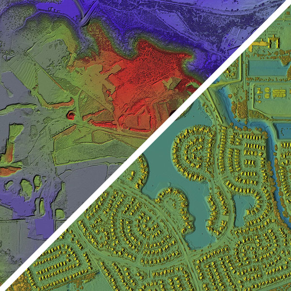
3-D Image of Lower Colorado San Bernard Lidar

3-D Image of Lower Colorado San Bernard Lidar

Product Specification
-
Vertical NVA RMSEz tested 4.9 cm . The tested accuracy in all areas meets the project specification for 10 cm.
-
Average first-return point density meets the 2 ppsm project specification.
-
Point data is classified according to the following American Society for Photogrammetry and Remote Sensing (ASPRS) class schema:
- Class 1: Unclassified
- Class 2: Ground
- Class 7: Low Point (noise)
- Class 9: Water
- Class 10: Ignored Ground
- Class 14: Culverts
- Class 17: Bridges
-
Projection Specifications
- Horizontal projection is UTM NAD83 (2011) Zone 14
- Vertical projection is NAVD88 Geoid 12B
- Units are in meters denoting orthometric heights
 christoball
 @christoball here is the coverage map.
  @christoball the caption circle in the image need to change from "3D Lidar Point cloud" to "Bare Earth Digital Elevation Model"
Data Story please copy all content for news article into this issue.