 aerostitch
commented
10 years ago
aerostitch
commented
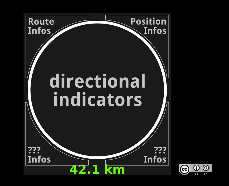
10 years ago 2014-08-06 17:43:53: thomas.maus@gmx.de uploaded file general_layout_concept.png (70.1 KiB)
general layout plan
Open aerostitch opened 10 years ago
aerostitch
commented
10 years ago general_layout_concept.png (70.1 KiB)general layout plan
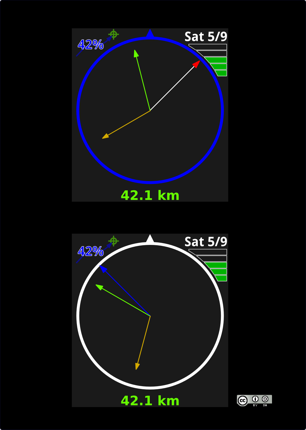
aerostitch
commented
10 years ago simple-pointers+infos.png (100.7 KiB)simple design with routing and positional status
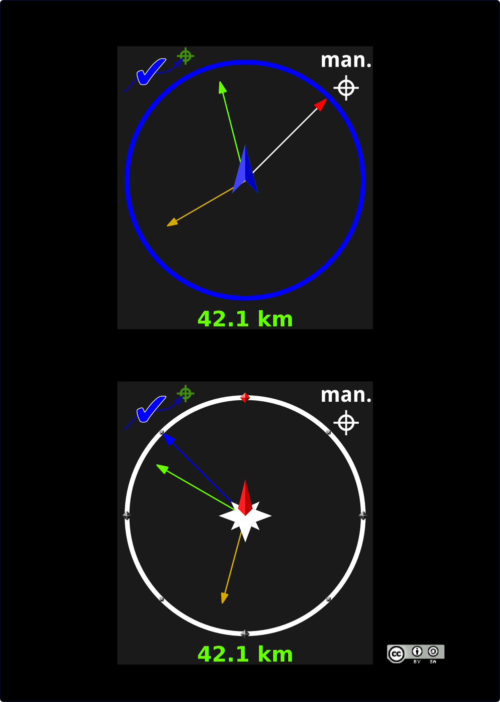
aerostitch
commented
10 years ago design3+Route_found+Manual_Position.png (95.9 KiB)elaborate center ornaments + route calculation succeeded + current position manually set
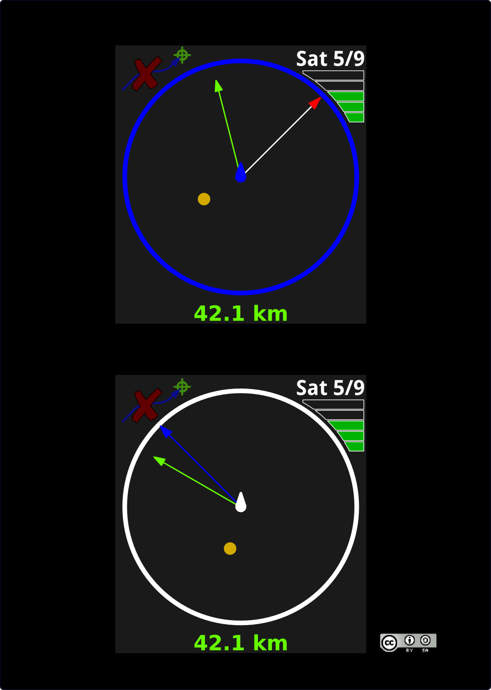
aerostitch
commented
10 years ago design4+Sun_Altitude+failed_Route+GPS_Position.png (94.1 KiB)simple center ornaments + failed route + GPS position
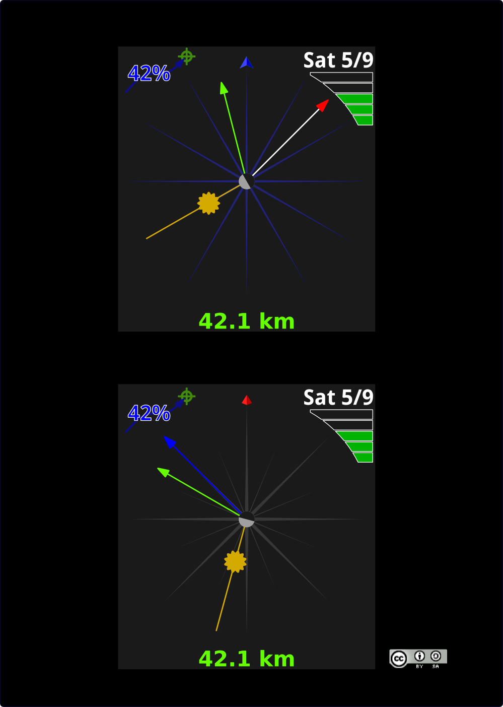
aerostitch
commented
10 years ago fancy_design_with_ring.png (141.1 KiB)fancy design with elaborate sun pointer and background compass roses
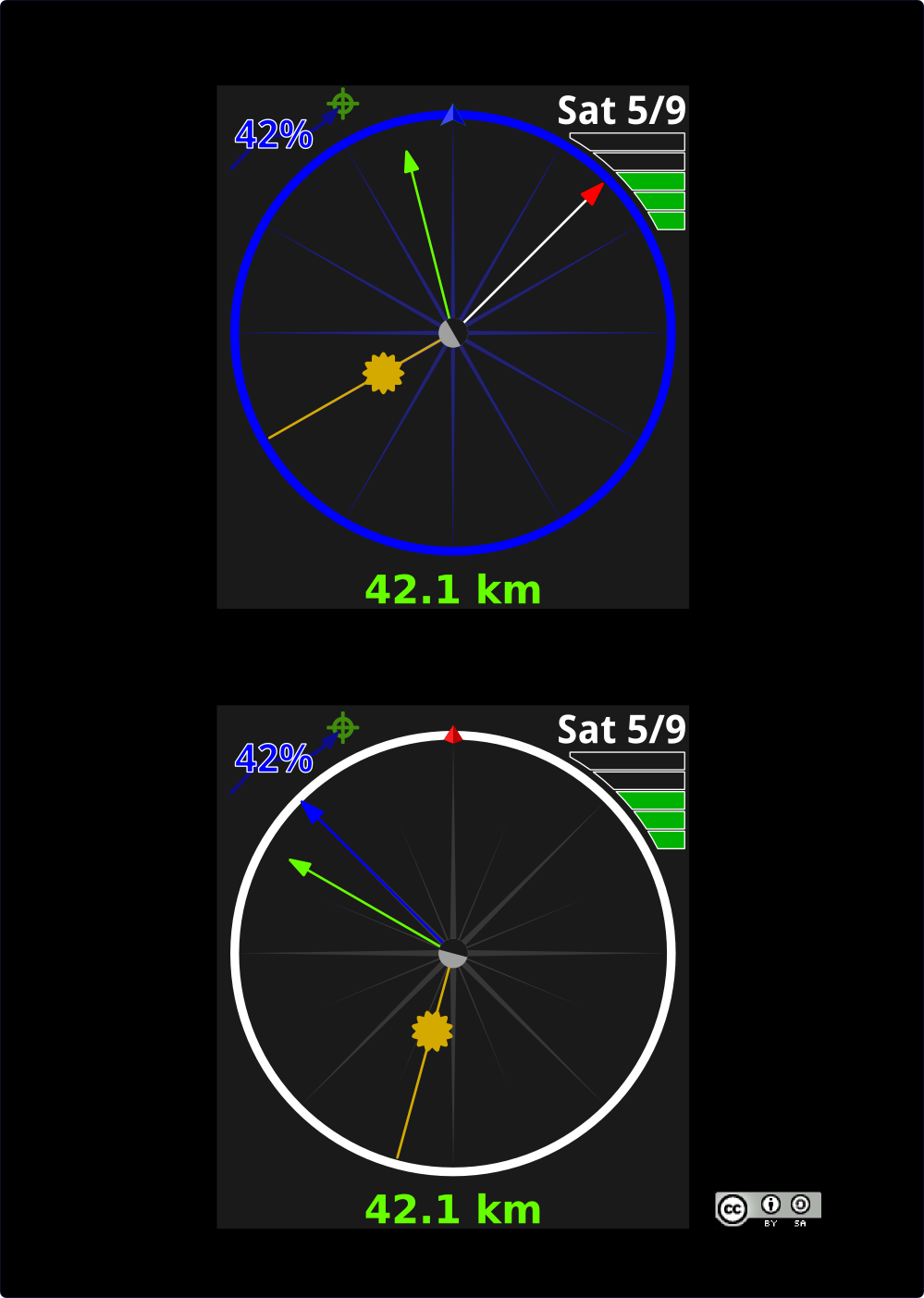
aerostitch
commented
10 years ago fancy_design_without_ring.png (104.8 KiB)fancy design, but less is more: leaving out the rings
aerostitch
commented
10 years ago aerostitch
commented
10 years ago See [http://trac.navit-project.org/ticket/1095#comment:8] for an elaborate example of why the clock-dial direction approach is advantageous, compared to turn strengthening or counting exits in round-abouts.
Issue migrated from trac ticket # 1226
component: osd/core | priority: major | keywords: gui, compass, widget
2014-08-06 17:42:48: thomas.maus@gmx.de created the issue