 Tomasz-W
commented
6 years ago
Tomasz-W
commented
6 years ago Yes, it's because of covered=yes tag. See https://github.com/gravitystorm/openstreetmap-carto/pull/3162
Open MaartenDeen opened 6 years ago
Tomasz-W
commented
6 years ago Yes, it's because of covered=yes tag. See https://github.com/gravitystorm/openstreetmap-carto/pull/3162
 kocio-pl
commented
6 years ago
kocio-pl
commented
6 years ago Thanks for the report.
This helps to avoid situations like this:
If the tagging is more specific (like covered=trees or covered=partial), platforms are being rendered.
 matthijsmelissen
commented
6 years ago
matthijsmelissen
commented
6 years ago I don't see a reason not to render covered platforms. It might just mean that the platform has a roof over its full length. Not rendering underground platforms makes more sense, but covered=yes does not imply underground.
matthijsmelissen
commented
6 years ago I don't see a reason not to render covered platforms. It might just mean that the platform has a roof over its full length. Not rendering underground platforms makes more sense, but covered=yes does not imply underground.
kocio-pl
commented
6 years ago There was a report on this before - what do you think about this reply? https://github.com/gravitystorm/openstreetmap-carto/pull/3162#issuecomment-396536436
kocio-pl
commented
6 years ago It might just mean that the platform has a roof over its full length.
I was assuming exactly this and found it to be a problem too.
 MaartenDeen
commented
6 years ago
MaartenDeen
commented
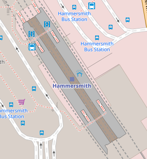
6 years ago That issue is about clearly defined underground platforms, tagged with location=underground. This platform does not have such a tag so it should not be treated as such. In addition, then why is this way rendered? https://www.openstreetmap.org/way/288846045 It has the exact same tags as https://www.openstreetmap.org/way/288846041 which is not rendered.
kocio-pl
commented
6 years ago I would not go with trying to explain it in the framework of underground, as I said I was aware that this is another, but similar kind of problem (without assumption that it is underground). So please let's focus on the question whether covered should or should not be rendered (and why yes or why not).
Tagging on this station is not clear to me - there's also https://www.openstreetmap.org/way/288846038, which looks that platform 2 is probably duplicated and some of them overlap. Please review this and fix if possible.
MaartenDeen
commented
6 years ago I think if it is underground (and tagged as such), the reasoning to not render it is valid. If it is not underground, than it should not be treated as such. Or at least be rendered as something visible.
BTW: 288846038 does not overlap. I do see a difference though, 288846045 is in a multiplolygon relation for a platform which is not covered, and as such will probably be rendered because of that. 288846041 is not. To clarify the tagging of the platforms: I created different parts for different sides (platform 2, platform 3), different sections (platform 3a, platform 3b) and made the covered part also a different way. Yes, convoluted, but sometimes it is trying to find the best solution for an envisioned problem.
kocio-pl
commented
6 years ago Quick investigation (exporting OSM file and replacing names with something like 2x, 2y etc): there are like 4 objects named "Perron 2", and the rendered name comes from https://www.openstreetmap.org/relation/7831438, because it has no covered=yes tagging.
Are you sure you need all 4 with the same name "Perron 2"?
 naomap
commented
5 years ago
naomap
commented
5 years ago Many railway platforms are not rendered indeed, for instance https://www.openstreetmap.org/way/140249174 which holds the tag covered=yes. This is indeed different from location=underground and I think it should be rendered.
This seems to be caused by this piece of code, line 688 in project.mml AND (covered NOT IN ('yes') OR covered IS NULL)) That doesn't mean I feel able to fix it !
 jragusa
commented
5 years ago
jragusa
commented
5 years ago I think the tag cover is not appropriate for such situation. They are not covered by a superstructure like a glass vault (verrière) such as at the Bordeaux train station. shelter is much more appropriate for a marquise, especially because the platforms are not entirely covered.
An additional possibility should be to map the marquise as a building roof.
 aceman444
commented
3 years ago
aceman444
commented
3 years ago I also wondered why https://www.openstreetmap.org/way/388148758 is not rendered and came across this issue.
Notice a close highway=platform (a bus platform) is rendered fine even when covered=yes: https://www.openstreetmap.org/way/126362312 .
I came across this railway platform that does not get rendered anymore: https://www.openstreetmap.org/way/288846041 An adjacent platform is getting rendered: https://www.openstreetmap.org/way/548528350
The only difference I see is covered=yes on the one that does not get rendered. I'm sure it was being rendered in earlier versions of the stylesheet.