 AndySwiss
commented
2 years ago
AndySwiss
commented
2 years ago I have the same problem

 `General
Name Bel4
Path C:\Bel\Bel4.tif
Sidecar file Bel4.tfw
Total size 2.20 GB
Last modified lunedì, 17 gennaio 2022 02:37:28 (Bel4.tfw)
Provider gdal
`General
Name Bel4
Path C:\Bel\Bel4.tif
Sidecar file Bel4.tfw
Total size 2.20 GB
Last modified lunedì, 17 gennaio 2022 02:37:28 (Bel4.tfw)
Provider gdal
Information from provider
Extent 2721999.9899999997578561,1116000.0000000000000000 : 2723000.0099999997764826,1117000.0200000000186265
Width 33334
Height 33334
Data type Float32 - Thirty two bit floating point
GDAL Driver Description GTiff
GDAL Driver Metadata GeoTIFF
Dataset Description C:\Bel\Bel4.tif
Compression LZW
Band 1
STATISTICS_APPROXIMATE=YES
STATISTICS_MAXIMUM=480.14999389648
STATISTICS_MEAN=290.77781378413
STATISTICS_MINIMUM=222.44999694824
STATISTICS_STDDEV=62.555380775828
STATISTICS_VALID_PERCENT=99.88
More information
TIFFTAG_ARTIST=created by LAStools (c) martin.isenburg@rapidlasso.com
TIFFTAG_SOFTWARE=LAStools is a product of rapidlasso GmbH, Germany
Dimensions X: 33334 Y: 33334 Bands: 1
Origin 2.722e+06,1.117e+06
Pixel Size 0.02999999999999999889,-0.02999999999999999889
Coordinate Reference System (CRS) Unknown
Identification
Identifier
Parent Identifier
Title
Type
Language
Abstract
Categories
Keywords
Extent CRS Spatial Extent CRS: - Projected X Minimum: 0 Y Minimum: 0 X Maximum: 0 Y Maximum: 0 Temporal Extent Start: End:
Access
Fees
Licenses
Rights
Constraints
Bands Band count 1
Number Band No-Data Min Max 1 Band 1 -9999 222.4499969482 480.1499938965 `
 jawensi
 yceballost
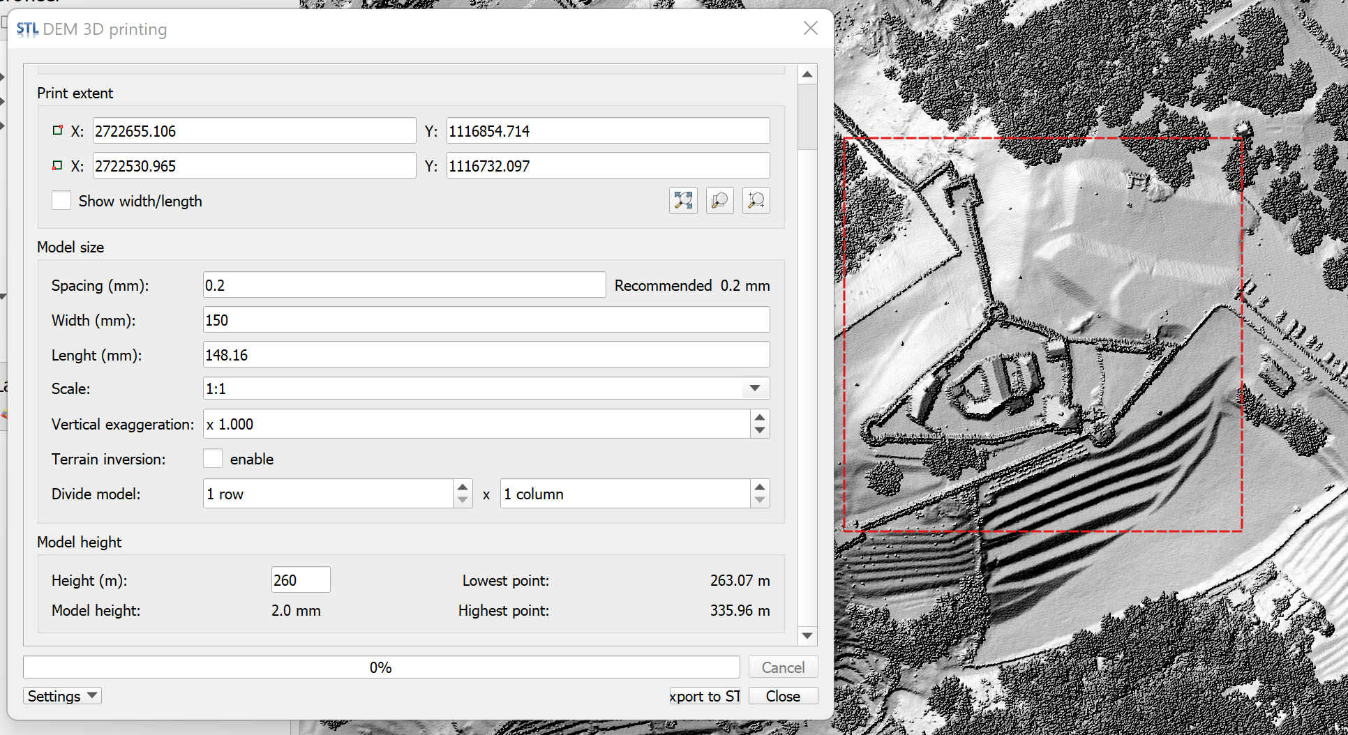
Hi!
I'm trying to use this plugin with QGIS but when I use it, a rectangle is exported in .stl.
Any help?
Thanks in advance! And thanks for the plugin!