 kunchapu
commented
8 years ago
kunchapu
commented
8 years ago 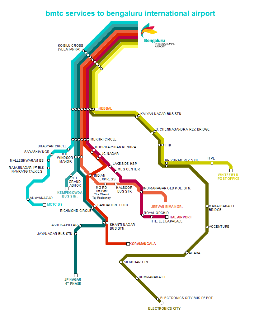
Closed planemad closed 8 years ago
kunchapu
commented
8 years ago
 nikhilshivpuja
commented
8 years ago
nikhilshivpuja
commented
8 years ago Existing map on the bmtc site

 tantadang
commented
8 years ago
tantadang
commented
8 years ago Map given in the BMTC Brochure. 
 planemad
commented
8 years ago
planemad
commented
8 years ago Location of bus stops, bus stations and railway stations: http://overpass-turbo.eu/s/dxl

planemad
commented
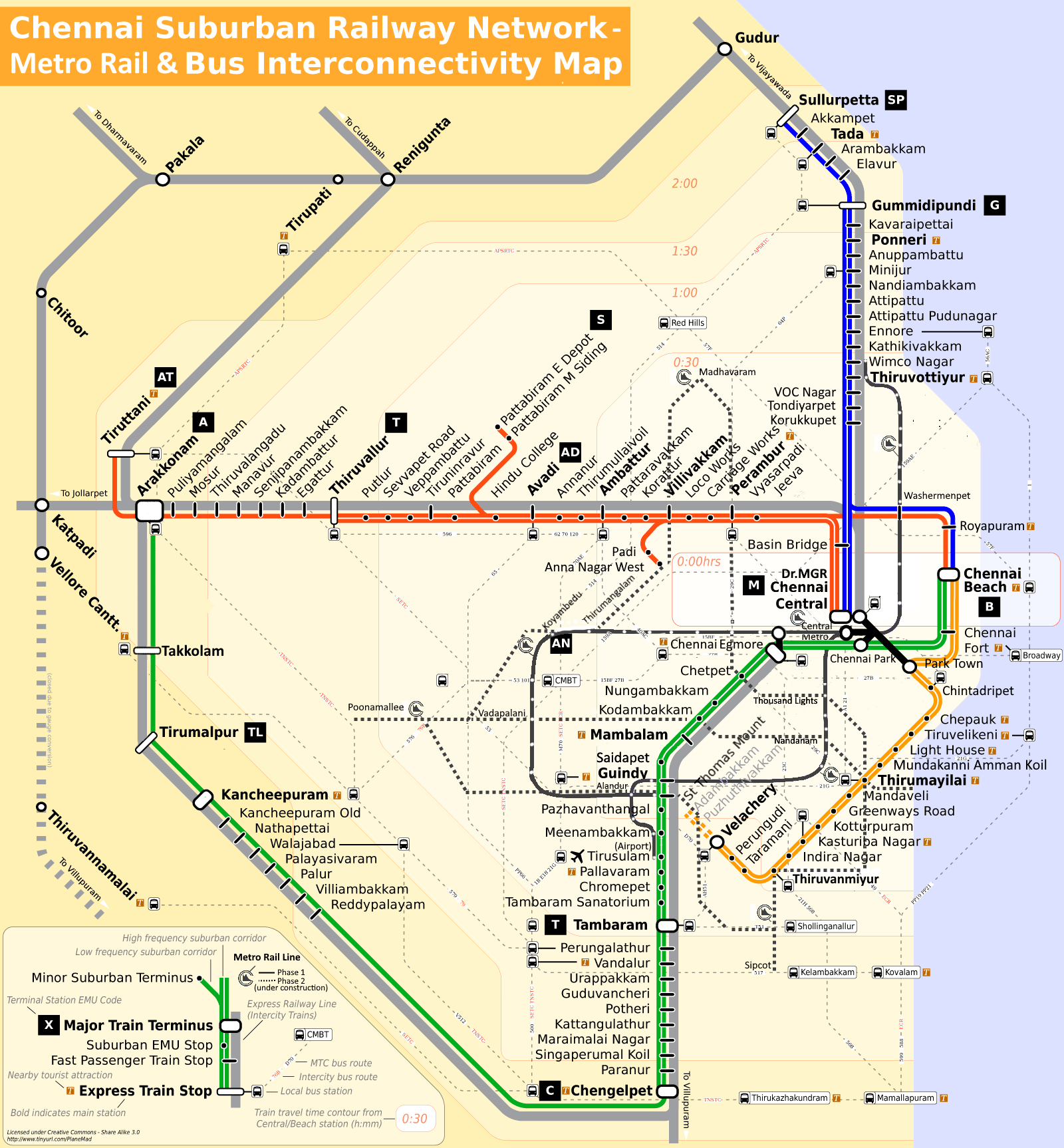
8 years ago Some of my past schematic maps:
 prajography
commented
8 years ago
prajography
commented
8 years ago First Exploration

 arshedhakeem
commented
8 years ago
arshedhakeem
commented
8 years ago 1st exploration

tantadang
commented
8 years ago BIAL Buses to Airport V1.0 
planemad
commented
8 years ago prajography
commented
8 years ago Hello Arun Made some modifications to the map. I need some help figuring out the railway and metro routes.

planemad
commented
8 years ago @prajography the bus routes are starting to look really nice, especially the colors. You should add markers at the stops that you feel are important and also where the subway/railway connects with the bus route. You can then start distorting the rail lines that do not intersect with the bus routes freely.
Also you can choose where to diverge routes, create turns in a way so as to maintain symmetry and order with other elements. Use guides to help align elements neatly and they will look much better to the eye. @tantadang has done this very well https://github.com/mapschool/course/issues/2#issuecomment-169367465

 nehaarsid1
commented
8 years ago
nehaarsid1
commented
8 years ago Exploration 1 : I tried to show all the bus stops with most frequent routes having thicker lines and first common bus stop of different bus routes being highlighted.

planemad
commented
8 years ago Grading done.
planemad
commented
5 years ago Bengaluru International Airport Ltd (BIAL) has invited artists and architects to participate in a map design contest. The three best-designed maps, with artist credit, will be printed and made available as takeaways for passengers. The map must fit to scale, follow city boundaries and highlight key landmarks/locations. The design must be unique, original, and must not be in circulation, exhibited or created for other purposes. Applicants can submit their design in soft copy with a concept note about the inspiration behind the illustration. The date for submission is October 15. The top three winners will not just win prizes but also get a chance to showcase their talent to millions of people each day. Interested participants can send in their entry to artprogramme@bialairport.com https://www.thehindubusinessline.com/news/national/bengaluru-airport-announces-map-contest/article29399183.ece
cc @mapschool/infdpg16 @mapschool/infdpg15 @mapschool/infdpg14

Brief: Create an information graphic to help a foreign traveller decide a convenient route and mode of transport to reach the Airport from the city.
Evaluation
Data sources
cc @mapschool/infdpg14