mapschool / course

An introduction to the art and science of modern cartography
MIT License
51 stars 11 forks source link

#2 Schematic Hometown Mapping #65

Closed rasagy closed 2 years ago

rasagy commented 2 years ago

Hi everyone,

As discussed in the class, let’s pick our hometowns/city we are familiar with, and create schematic maps. You can find the slides from our class here.

The audience can be tourists (general, or specific type of attractions like pilgrimage, lakes etc.), or a specific use case (such as cycling, educational institutes etc.).

You can see some of the previous schematic map exercises for reference.

You can follow the following steps for your schematic map:

  1. Scale, Audience & Purpose
  2. Mental model sketch
  3. Tracing relevant aspects from OSM
  4. Abstraction: Grids & geometric shapes
  5. Simplification vs Minimal
  6. Elements of the city
  7. Visual hierarchy
  8. Details: Icons, Typography, Legend, Context

Here are some references to go through:

Schematic Maps:

Cartography / Map Design:

Resources:

Maki icon set for using quick icons under CC0 license, do try editing them in the Maki Editor if you want to customize them.

chickensoup28 commented 2 years ago

Schematic Cartography

 Submitted by- Souporno Mukherjee
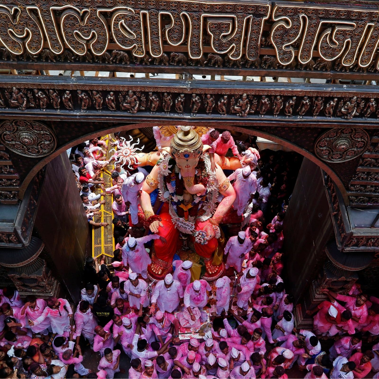
 Topic- Photogenic spots of Bokaro Thermal Power Station 

Bokaro Thermal

Small town/village in Jharkhand. The town is based around a thermal power plant and all it’s livelihood directly or indirectly come from the power plant itself. I grew up here. Stayed here for my father’s job. The power plant is a part of the organization called Damodar valley corporation (DVC) the township is based alongside river Damodar and the power plant generates electricity using coal from the coal mines around.

  1. Characters of a colony- What does a colony say about itself? different tiers of quarters for the officials working in the power plant creates similar looking yet different colonies what do these colonies tell about themselves?

  2. Picturing the power plant- The power plant is the sole spot that defines the town you can see it from almost every where. What are these spots that you can picture (take a photo) the power plant from such that you have the essence of the town with you. the town is scenic beautiful and lush green in contrast to the power plant.


Shibpur (Howrah)

I visit my hometown mainly during vacations and specially during Durga puja. I know the area and the the nearby surroundings pretty well. The town is based in Howrah and falls under the old city planniny with dingy alleys and roads surrounding it.

  1. Durga puja pandals- What are the nearby areas/traditional homes and committees that organize and celebrate durga pujas and what is so specific about their puja that one should visit them. (as it is a local event there wont be any information on google or concise on the internet.)

Cuttack

I spent five plus years of my college life here. Hung out with friends. Cuttack lies between 2 rivers and is considered a river island. I stayed in an area called the Cuttack development authority area (CDA)

  1. Where to find a good gossip place?- What are the spots in and around CDA where you can hang out and for cheap with friends while enjoying a meal or a tea or some snacks or just while enjoying a scenic view.

  2. Places to go on a date in? - College life, regressive town what are the best places you can go on a date in in around and nearby CDA to Badambadi (Centre) area in Cuttack.

Initial thoughts

Untitled_Artwork (2)

Feedback on selected topics

  1. I don’t see the first section (characters of a colony) being easy to highlight on a map. I feel a lot of subjective discourse will be hard to embed, and the intended audience for this seems very narrow.
  2. Spots to picture the power plant seems interesting if you feel this is spread out across the city. Pair this with key places to visit & you’ll have a good map purpose!
  3. I feel topics like pandals are very time-specific, and change/evolve over the years. I would avoid such a topic for this exercise.
  4. 4 & 5. Could be mixed — it seems the target audience is similar and a mix of hangout spots (to talk / go on a date) would also lead to a good map. How large is CDA and does it give you enough scope for a map?

    Topic Selected- Picturing the power plant- The power plant is the sole spot that defines the town you can see it from almost every where. What are these spots that you can picture (take a photo) the power plant from such that you have the essence of the town with you. the town is scenic beautiful and lush green in contrast to the power plant.

I started off by creating the blind map marking the important places around my home and then marking out picture spots in and around the area to see how many I could locate directly from the back of my mind. Untitled_Artwork (2)

The inspiration for this would come from the 36 views of mount fuji which is visible from the city thoughout Fuji-City-Mt-Fuji

This is how the power plant looks from my Balcony Untitled_Artwork_(4)r

I noted down headers of what to call the map by Untitled_Artwork (4)

Next I stitched screenshots of Google maps to get the area to trace from that I was looking for Untitled_Artwork (3)

Since these are picture spots was considering if an isometric map with some elevation data would work. (Example in image below) Also would a map like this qualify to be a schematic map? Screenshot 2022-03-10 085854


Feedback-

Next I overlaid open street map view over the google map stitch and started first level of abstraction of the map Untitled_Artwork (3)

Here is how the level 1 abstraction looks. Next I shall go for reducing the roads further, keeping/adding points of interest and points of reference.

Untitled_Artwork (4)

Abstracting road layout with 45 degree grid. Untitled_Artwork (6)

Feedback-

Trying out isometric illustrations to visualize the the power plant Untitled_Artwork (8) The isometric illustration clashes with the underlying grid and starts to look a bit jarring on the map.

Feedback-

Attempt 2 ugggo

Desired result (attempt 4) ioijgd

Next the map elements will be extrapolated and overlaid on the existing road layout. Tags will be added with icons if and where necessary. Line variation to show change in area/type of road/crossing to be done. Color and visual hierarchy to be checked.

Road layout with superimposed depth of buildings, bridges, train lines, and other line character gyj

Desaturating building depth and simplifying line character to bring focus on required areas and to maintain visual hierarchy hdh

First layer of text addition hcvj

Final Outcome Frame 4

Edit with minor adjustments Frame 6

ginaphil commented 2 years ago

Schematic Cartography

Ideas for the map

group 1 1

I lived in Chennai for 3 years - the normal IT life. I reached Chennai knowing nothing about the place. This map could be a guide, were not to get an auto from, where to go for that early morning dosa, evenings with momos, panipuri, OMR food Street or that once in a while rooftop beer😅

Group 2

Kottayam is the place with the first printing press in Kerala. It's called Akshara Nagari, the city of alphabets. This map will be a guide to bookstalls, libraries, etc. and maybe the 1 or 2 cafes or parks where you could sit n read and the railway station nearby because train travel mandates a book!

Group 3

If you have a day to visit Fort Kochi on foot, what would you want to see, - the beach, the jew street, synagogue, a few art cafes maybe. This is Kochi for artists, designers, architects, and art enthusiasts

Still confused between the two topics ( even though I have a slight bias towards Kottayam, I went ahead and sketched a conceptual map of both 1st and 2nd options..... unnamed unnamed (1)


Finalized the map of Kottayam as the place is more close to home and since the story of finding books and those rare ambient cafes to read in the city of words in more strong and passionate.

Since my memory of the town is a little vague, I talked to a friend from the town and came up with the second version of a Conceptual map noting down the major landmarks and the main bookstalls, and the best cafes unnamed (2)

As a next step, I traced the important roads on the open street map to understand the map structure

unnamed (3)

Mapping the bookstalls, libraries and cafes as points of interest in the open street map Group 10

1st level of Abstraction image

2nd level of Abstraction - looking at various levels to simplify image

image

Feedback: To try a 30--60-90 grid instead of an isometric and to try to squish the map a little on the right side and broaden a bit on the left to obtain the book metaphor map Unsure with the form, the next set of iterations were a redo of the grid and road layout unnamed

a custom layout was made Artboard 2

unnamed (4) Artboard 2

Adding Labels

Artboard 2 copy 2

Adding more labels map

zooming in map zoom

the K map A4 - 5

Working on colours and fonts kmap

Trying a green colour palette representing kerala kmap w A4 - 11 A4 - 14

Final Map

kottayam map

SudevKiyada commented 2 years ago

Brainstorming ideas for the schematic cartography

  1. Rajkot, also known as Chitranagari is home to more than 50,000 wall paintings all over the city thanks to a programme kickstarted in 2015 under the motto of “Swachh Rajkot, Sundar Rajkot”. Intention for the map is to help art enthusiasts explore the paintings made by the people of the city.

  2. Garba is integral part of any Gujju and Rajkot is no different as it starts grooving to the garba tunes 3 months before the Navratri. Each district of Gujarat brings on a unique form of Garba. A garba enthusiast can learn the dance form at any of the numerous dandiya classes all over the city and can groove to the tunes at the places organised during the festival. The intention to create this map is to help a garba enthusiast right from learning the dance form at any of the classes to the places where the masses meet to groove during the 9 days of festival.

  3. Rajkot is touted to be the largest automobile zone in whole of Asia in the near future. It is home to many small and medium-scale automobile parts manufacturing industries and there are clusters of industrial zones surrounding the whole city. The intention is to map the different industrial zones along with information about types of industries to help a potential investors and people who want to set up a new industry in Rajkot.

Topic : Map of Rajkot as Chitrangari for art enthusiasts

  1. Started off by making a mental map of the major roads in the city where walls are painted by the people. BLind Map

  2. For the next step, I started tracing the actual map after pinning multiple locations. Step 2

  3. Started making the overall layout. Still adding few more pathways. Focus is to make it simplistic but detailed enough for any travelers to be able to make out the exact turns. Step 3

  4. Step 4

  5. Tried showing both the sides of the road to give better visualization of on which side the painting is. Step 5

  6. Added colors and wall painting markings. Step 6

  7. Final rendition of the map. Final Map

rasagy commented 2 years ago

Great ideas folks!

For @chickensoup28:

  1. I don’t see the first section (characters of a colony) being easy to highlight on a map. I feel a lot of subjective discourse will be hard to embed, and the intended audience for this seems very narrow.
  2. Spots to picture the power plant seems interesting if you feel this is spread out across the city. Pair this with key places to visit & you’ll have a good map purpose!
  3. I feel topics like pandals are very time-specific, and change/evolve over the years. I would avoid such a topic for this exercise.
  4. & 5. Could be mixed — it seems the target audience is similar and a mix of hangout spots (to talk / go on a date) would also lead to a good map. How large is CDA and does it give you enough scope for a map?

For @ginaphil: I love all the topics! As I had suggested earlier, if you're not sure about your knowledge, then I'll recommend picking the one that you have the most confidence in (= the one for which you need the least time to collect data).

For @SudevKiyada:

  1. I’m assuming you can’t map out all 50000 paintings. 😅 Are there specific areas that have most of these paintings? A map highlighting the main areas + how to get to them + what else to do around them would be quite good!
  2. Like the earlier pandal topic, I would nudge you to avoid topics that are only relevant during a specific time period, and might change over time.
  3. While I like the unique theme, I’m not sure if a map will be the right artifact for an investor. Designing for such an audience would require a lot more data & context, and I feel your map might only provide a small part of the information they will need. In your case, I recommend going ahead with (1).
Tej333 commented 2 years ago

Thejashwini D

The map is not a territory: The theory isn't what it describes, it's simply a way we choose to interpret a certain set of information.

Memoir A walk to remember

A visual interpretation of the multisensory experience of RR Nagar. During the past 10 days, I have been experiencing the place I live in my own way . I spanned the entire area on foot. Capturing the smell, sound, visuals in my map will help my nonwalking friends go beyond and connect with my experience of my area.

image

MacBook Pro 16_ - 2

MacBook Pro 16_ - 1 (1)

image image <img width="1402" alt="Screenshot 2022-03-11 at 09 41 50" src="https://user

Screenshot_2022-04-03_at_18 51 45 2

Shoe metaphor to signify the walk

Smellscape -images.githubusercontent.com/36147802/157800657-8c319368-72fe-4ff4-a916-e31a7c141559.png">

kirtivardhanrathore commented 2 years ago

Step 1 / Brainstorming Ideas

1. Heritage walk in South Bombay A map showing all the historical places of SoBo with timelines of important events/demonstrations that happened there.

2. Food Map of Jodhpur Jodhpur’s food ecosystem has gone through a lot of changes during the last few years. A map to show food eateries around the city will be helpful.

3. A Tourists Guide to Pushkar Pushkar is regarded as the king of all pilgrimages of India as it houses the only Bramha temple in the world. A very small town famous for its camel fair has a lot of noteworthy hostels, restaurants, and places to visit. But it has a very complex street structure and it is difficult to find parking even on normal days let alone during the fare. A map to show all the worth visit places, and using what vehicle to commute on what street can come in handy

  1. Base Map of Pushkar Base Map

  2. Round 1 of Tracing Round 1 Tracing

  3. 90 - 45 Grid 90 45 180 Grid

  4. Working of a Polar Grid... (Idea Dropped)

  5. Conch Shell

    image

Marking down the points

Pushkar

Stylizing and Coloring

image

Having some fun

image

Final Map Frame 10

filterkaapier commented 2 years ago

Hi everyone!

While my family is from Kerala, I grew up in the beautiful Tamil capital of Chennai - சென்னை, erstwhile Madras. Studying architecture has made me fascinated with the history, the culture and the urban fabric of this busy city. I still feel like a tourist sometimes.

I have two ideas for a Schematic Mapping exercise on Chennai.


Mylapore

1. A Heritage Walk along the Peacock Trail:

Audience? Anyone curious about the culture, heritage and histories of Mylapore and Chennai, exploring the streets.

You can see the beauty of a city like Chennai - steeped in tradition and ritual- nowhere better than at Mylapore.

Mylapore (aka Thirumylai or the ‘Land of the Sacred Peacocks’) is a small neighbourhood in Chennai that predates the city itself, with about 2000 years of layered history. It is a cultural node, around which the city eventually grew.


2. Unwind-Rewild

Mapping the spaces in Chennai where the urban jungle has still not conquered the pristine greens. Where can someone who loves wildlife or nature go? The right place in Chennai for the crocodile crazy? Bird bingers? (On a larger scale than idea 1.)


The Peacock Trail: Mylapore

Going ahead with a cultural map of Mylapore-Santhome, Chennai.

1. Mental Maps

Started by making a quick mental map. The first thing I noted was how my awareness of the planning of the Temple and its Mada streets influenced the way I drew that part of the city.

Untitled_Artwork 70

A slightly more detailed map

I made a more detailed map of the neighbourhood, this time focusing on connections - both macro and micro - and a slightly detailed context. The places I remember most are centered around the route I frequently took, by bus and then by walk. Apart from the sacred and historical spaces, the places that stand out involve food. (not surprised, really)

Untitled_Artwork 69

2. Cropping & Tracing aspects from OSM & Google Maps

I then stitched together the areas I wanted to look at, with Google Maps and OSM.

Asset 1@4x

I cropped in to a smaller area based on where most of the points were clustered:

Artboard 1@3x

Tracing Roads

Tracing Roads

Adding all the locations, categorising by type and color (for my own ease of understanding)

Artboard 1 copy 2@2x

3. Beginning Abstraction & Explorations

- A Grid In order to move from the fully realistic map into a schematic presentation, I started by planning the grid. This was straightforward enough - the road networks themselves are very geometric with minimal shifting and straightening. I went ahead with a 45° grid.

Artboard 1@2x

- Attempt - 1: Rough Sketch To get a quick, low effort idea of what the grid would look like, I made an overlay sketch of the map. This helped me plan better for the upcoming explorations.

Untitled_Artwork 76

- Is there a metaphor hidden in here? Working on the grid, I attempted to see if a visual metaphor would emerge.

Mylapore is known as the 'Land of Peacocks' and there are references to peacocks everywhere in the neighborhood and its history. I took this as a starting point to see if I could create a minimal yet recognisable peacock feather visually with the road networks.

Untitled_Artwork 77

I struggled for a bit with this level of simplification. I tried to make things easier to plot by labelling the roads and simplifying them. It was confusing nonetheless.

Feedback

  1. While going down the peacock feather metaphor route, the intersecting crossroads that did not fall into the main form would create confusion and it would look more like a maze and no longer resemble a feather.
  2. It would be confusing to navigate as well.
  3. Perhaps, this level of stylisation could be explored later on, after a more navigable version?

4. Back to the Grid - Simplification

Taking note of the feedback, I went back a step and explored further with the geometric grid. I abstracted the roads to a very regular form and added the markers.

Base Map

Artboard 1 copy 2@2x

Exploration

Simplification

5. Visual Hierarchy

Here, I attempted to create a visual hierarchy of the roads, with the most important and largest roads being the most prominent. The anchoring roads are given larger labels. The smaller and pedestrian level roads were made less opaque. One could navigate to the landmarks with the named main roads and a general idea of the location within a particular block, with the schematic map.

The two Mass Rapid Transport System (MRTS) Stations were made more rectangular, closer to the mental model of the long rectangular station buildings.

Some visual freedoms were exercised, with some scaling and stretching to create more space at highly dense clusters of landmarks, since I was planning on adding a couple of illustrations further on.

Screenshot 2022-04-04 at 9 16 10 AM

6. Detailing: Iconography & Legend

I explored some ways of depicting the landmarks within a consistent visual language. Since the icons would be very small, sufficient recognisability was important. Too many details would cause visual clutter.

There are many points in a very tightly packed area. Adding typography there would add to the cognitive load and confusion. Hence, I decided to only have an icon of the category of landmark on the map itself and pull out the names and specialities in a legend to the side of the map.

Asset 1

Explorations in Layout

Composition


Draft - 1

Added a grainy edge to the shore/ocean line to distinguish it from the man-made canals and tanks in Mylapore. A little neighborhood dotted with temples, churches and Madras saapadu(food), right along the beach!

Mylapore Schematic Draft 1@3x

To revise:

  1. Add one version with illustrations of temple, church and lighthouse
  2. Retry a landscape composition.
aashibhaiji commented 2 years ago

Koramangala

About Koramangala is situated in the south-eastern part of Bangalore, it is one of the largest neighborhoods, and is a residential locality with wide, tree-lined boulevards and a mix of commercial structures, and bungalows. Planned as a suburb post-independence, its location between Bangalore and Electronic City attracted migrants from across the country during Bangalore's tech boom of the late 1990s. Consequently, it has gradually developed into a commercial hub. Koramangala is also Bangalore's prominent startup hub. Koramangala is largely cosmopolitan in nature. It is the focal point of many busy main roads, notably the Intermediate Ring Road.

Connectivity Linking the Airport Road with Hosur Road and Electronics City, Sarjapur Road leading to the Outer Ring Road, the IT corridor and beyond and 80 Feet Road leading to Viveknagar and MG Road at the center of Bangalore. It commands one of the highest property prices in the city and is considered by Bangaloreans to be one of the better places to live, although commercialization in the form of shopping centres, malls and restaurants, increasing traffic and population have posed problems for its residents.

Educational Institutes Koramangala is also home to many educational institutions like the St. John's Medical College Christ University, Indian Institute of Plantation Management, Amity Global Business School, NuSkillz Academy, Jyoti Nivas College, Vemana Institute of Technology, Indian Institute of Astrophysics, NMIMS, TAPMI

Software Companies Several software companies have locations in Koramangala, including Microclix, IInfosys, Wipro, NDS, Siemens VDO, Microland, ThoughtWorks, Zenith Software, Tally Solutions, Methode Electronics, Robert Bosch GmbH, Mindtree, Lucent Technologies, Toshiba, Software India Pvt. Ltd. (TSIP), Piterion, Ciber, IT training Company Koenig Solutions Ltd., Artefacts and the Indian e-commerce firm Flipkart

Topics

  1. Parks and Recreational Spaces in Koramangala
  2. Mapping South Indian Restaurants of Koramangala (or) Koramangala's Best Breakfast Spots
  3. Mapping the educational institutes and major software firms in Koramangala4.

Selected Topic : South Indian Restaurants of Koramangala

Selected Places : Sukh Sagar, IDC Kitchen, Sendhoor Coffee, Shree Krishna Cafe, Falahaar, Shri Krishna Sagar Veg, Podi Idly, 99 Variety Dosa, Kota Kachori, Anand Bhavan, Indian Coffee House, Shanti Sagar, Udupi Upahar, Sagar Fast Food, A2B

Audience : This map is useful for students/professionals who always want to start their day with a good breakfast


Tracing and Finding Metaphors

Trying to trace out major roads, landmarks, nodes, intersections to figure out which are really important to show to figure out a structure that works on geometry or metaphor (trying to force fit a metaphor of a dosa with the inner road details being the texture of the dosa but failing at figuring it out). Also, experimenting with curved lines, straight lines, orientation of map.

Labels and details in the map that will be included : Road Names, Nearby Landmarks, Direction of Moving Traffic, Approx Prices of Places (yet to add more...)

Map (4)-01 Map (5)-01 Map (6)-01 Map (7)-01 Map (8)-01 Map (9)-01

Figuring out the details of the map in terms of most important roads, density of the inner roads, landmarks and major intersections

Map (1)-01 Map (2)-01 Map (3)-01

I also zoomed out a bit and tried to figure out a structure

Map (10)-02

Map (11)-02

Next Steps : Finalise on the structure, highlight most important inner roads and work on visual language


I finalised the main roads, inner roads, restaurants, landmarks, important junctions, garden areas, marked the blocks and added labels.

Map (1)-03

Next Steps : Simplify the roads using a grid, add visual hierarchy to the elements, work on visual language and colour scheme


I used a 90-45 grid to simplify and abstract the map.

Map Abstraction-04

abstract-04


WIP... iteration1-05


Iteration 1-04


Map 2-06

Feedback Received : Hey Aashi, I think this is coming together quite well. I’m unsure about the pattern — it feels too strong IMO. Want to bring down the opacity for that? For the breakfast places, do you want to pick a different color than the roads? Or maybe make the roads in the yellow and keep the PoI in red? If you prefer to keep the red color for both, then maybe the labels should not have the yellow background? I don’t think the label & dots feel connected.


Iterations : Road and Label Colours, Shading and Pattern, Typography, Layout, Hierarchy, LineWeight, Contrast, Features

Map Final-01

Map Final-02

Map Final-03

Map Final-04

Santoastiesm commented 2 years ago

Topics

1. Idly and vada are great but have you tried Atho, Caddalai or Shark puttu in Madras ?

An ode to all the common foods of Madras that are deemed exotic even by some local people. Looking beyond Mylapore, Madras tends to offer a wide variety of cuisine for each locality from Atho of Parrys corner to 1am buttermilk man by the beach of Thiruvanmiyur, These are some unique experiences that even the locals miss out on, the emphasis is to bring awareness and make people look beyond the filter coffee/ Mylapore stereotype.

2. Esplanade of Madras through its architecture

There are varied arch styles that one can see in Esplanade stretch, such as

An experience of 17th century to 21st century Madras in a walk of 10kms, a melting pot of different architectural style ruled by various rulers and all of them have left a mark in the cities growth.

Comprised of

Focus is on highlighting the temples, monuments, offices, walkways and pathways connecting to these places.

Mind Map of the spots

Asset 1

Actual Spots

chennai_spots

Initial Abstraction Madras-beyond-filter-cofffee_final_wgrid

Schematic Abstraction

1Madras-beyond-filter-cofffee_final_wgrid

Madras-beyond-filter-cofffee_final_wgrid_wip

PGauri commented 2 years ago

Schematic Map of Irani Cafes in Mumbai

Topic Selection

Brainstorming on topics for the map:

  1. Map of locations where movie scenes have been shot in Mumbai

  2. Map of major Ganpati pandals to visit during Ganesh Chaturthi in Mumbai

  3. An introvert's guide to Mumbai (A map of fairly quiet places to be by yourself)

  4. Map of places that make the best vada pavs in Mumbai

  5. Map of Irani cafes in Mumbai (Selected)

Scale, Audience and Purpose

Creating a dataset of my favourite Irani cafes

Artboard 1

Scale, Audience and Purpose

Artboard 7

Creating a Blind Map

Artboard 6

Tracing Relavant Aspects from OSM

Marking the Irani Eateries on OSM

map pointers

Marking the paths (the roads, the railway lines and the queen's necklace)

map arteries

Marking Nodes

map nodes

Marking Landmarks

map landmark

Tracing the contours of the land

map

Simplifying the Map

major road 2

Removing the Roads Not Needed (Went back to the previous map after receiving feedback)

remove roads not needed

v2 schematic

irani grid-01

irani grid-06

irani grid-06

Elements for Illustration

(Dropped the Idea of making handrawn illustrations)

IMG_0059 image

image image legend

image

Creating Icons for the Map

Cafe buildings

ICONSET-03

Landmarks

LANDMARKS

Transport

transport icons

Referring to Old Maps of Mumbai for Inspiration

WhatsApp Image 2022-03-28 at 16 43 12

WhatsApp Image 2022-03-28 at 16 43 12 (5)

WhatsApp Image 2022-03-28 at 16 43 12 (1)

WhatsApp Image 2022-03-28 at 16 43 12 (2)

WhatsApp Image 2022-03-28 at 16 43 12 (3)

WhatsApp Image 2022-03-28 at 16 43 12 (4)

WhatsApp Image 2022-03-22 at 09 53 21

image (Source: https://www.geographicus.com/)

image (Source: https://curtiswrightmaps.com/product/seeing-bombay-city-suburbs-made-easy-through-this-road-rail-sea-air-route-map-guide/)

Some of the Iterations

image

Final

Version 1

Irani Cafes of Bombay-min

Version 2: Taking Inspiration from the Antique Maps of Bombay

mumbai schematic antique_v2

someshsahoo commented 2 years ago

Cuttack City.

Newcomers guide to Dahibara AlooDum in Cuttack What are the DA places one must visit in Cuttack. Most famous places to have Dahibara AlooDum.

Have a good time Different types of places to hangout and refresh yourself - Parks, Fields, Cafes, Restaurants etc.

Best street food spots in Cuttack Mapping to the best street food areas in Cuttack like Stadium, College Square, CDA 9 etc.

History hidden in plain sight Many local historical places like Bukhari Baba, Subash Bose memorial, Barabati ruins park etc are generally not mentioned and therefore remain are not explored more by visitors.


Going ahead with the topic History Hidden in Plain Sight

List of lesser known/visited historical places in Cuttack.


Memory Map WhatsApp Image 2022-03-15 at 7 47 42 AM


MostRoads

few deleted


Taking the first map further.

Straight

JustEdges


new

Further work to be done : Creating a grid structure, and adding landmarks


Added grid and extracted layout new

grid

extracted layout


Rotating layout , Adding components like Outer roads, inner roads, zones, green spaces, water bodies etc.

detailing


Choosing color schemes, adding details like names of components. Schematic 1 Schematic 2 Schematic 2try Schematic 2try2 Schematic 2try3

adding names of all components Schematic 2try5

Refining and adding final touches. Schematic 2try6 Schematic 1_1

Final


Final Schematic Map

Header 1

Final copy

Link to pdf for better resolution - https://drive.google.com/drive/folders/1lB9zQeufzL3MPuy6WhZlPh-hKT9v0TQ8?usp=sharing

Talphi commented 2 years ago

Hi Rasagy,

So the topics I had thought of were:

  1. A Cafe Hopper's Guide to Kolkata - A Map showing the most popular cafes in Kolkata and how to easily travel from one to another. The cafe culture of Kolkata started around 5-7 years ago and since then a whole lot of cafes have come up all over the city. For students in Kolkata, visiting and discovering new cafes is a part of their college life. This map would therefore be aimed at the college-going crowd of Kolkata, and would be curated of the most popular cafes in Kolkata.

  2. The Nerd and Geeks Guide to Kolkata

  3. The Ultimate Map of Kolkata Nostalgia/Romanticism - Kolkata, the City of Joy, has often been said to be more than a place - it's a feeling and an emotion. Whether it is sipping chai on the banks of Princep ghat early in the morning, or going to Maidan to play football and rugby with age-old friends, everyone has a story to tell about Kolkata. This map would be my curation of these buildings, parks, restaurants, and neighbourhoods, that have popped up time and again in conversations with friends over the years.

  4. The Cyclists' Map of Kolkata - A map comprising the best cycle routes to explore the city.

  5. Kolkata Biryani Battle - A curation of the best Kolkata Biryani in the city targeted at tourists and kolkata-bashis alike.

  6. A New Vision for the Old Ganga in Kolkata - Mapping the Adiganga

While 3. seems like the most interesting topic, I am a bit concerned that it would simply resemble my image of the city map that I did in first year.

  1. Seems interesting to me because while the data is available on blogs on the net, and news articles, no one has created a map to show the 'biryani neighbourhoods' of Kolkata.

The 6th one is something I have collected the data of before during my undergraduate thesis and shows Kolkata in an entirely new lens of the Tolly Nullah - the original path of the Ganga in Kolkata. What is even more interesting is the contrast of the city on either side of the Nullah and the how the Nullah not only acts as a spatial guide through the city, but also a temporal guide, connecting the original clusters of Kolkata together, bridging the pre and post-colonial neighbourhoods, and then leading to the newer growths of South Kolkata.

image

FINAL CHOSEN TOPIC: BIRYANI BATTLES

  1. Listing out locations and making a mental map of the city: 4

  2. Plotting Locations of Digital Map before Simplification 5

  3. Abstraction of the form and selection of roads:

8 6 7

  1. Refining the map and adding landmarks and locations:

Biryani Map

Frame 15

Frame 16

  1. I decided to explore a few different themes.

9

10

12

  1. Final:

13

  1. Scrollytelly version of the process:

https://talphi.github.io/Mapping-Biryani-Scrolly/

Abhimanyu-Saha commented 2 years ago

Hi Rasagy,

I wanted to share some of the topics I was considering, all of them related to Kolkata,

  1. The Tramways of Kolkata is not only one of the oldest in the country but also the oldest operating tramways in Asia. It remains one of the key attraction of the city yet with time, Tramways in Kolkata is losing popularity as well as operating capability (mainly due to the low speed of the existing trams and government negligence). My intention is to create a map for tourists/ travellers to choose a tram route and visit certain notable places while on the go.

  2. Before the Durga puja started being organized by clubs and organizations, it was mostly celebrated by the rich landlords (zamindars), and still, it has a totally different flavor of celebration, which attracts everyone, So a map of the notable Rajbari Puja (Locally called Bonidi Barir Pujo).

  3. Bengal, out of other things is famous for its Rosogolla (sweets), Shops which have crossed over 100 years are still running successfully and draws sweet tooths across the globe, A map for guiding enthusiasts will surely help them in their endeavor

TOPICS I AM WORKING ON: Kolkata Tramways Map & Misti Map of Kolkata

Kolkata Tramways Map:

The Kolkata Tramways used to be an extensive network of tramways to travel across the length and breadth of the city. The network reached its maximum span during the 90s but slowly started declining after that. Today, the tramways is still operating but in a limited capacity preserving the past within its two cars. Calcutta-1967 This is the map of the Tramways network during the 60s.

Screenshot 2022-03-09 072434 This is the map of the Tramways route that still remain operational

So, I started out tracing all the routes that were a part of the network in the past and the ones operating to show the state of network. I started out by tracing the routes

Slice 1

The black lines indicate the ones still operating

Then started to address the question that "Why would anyone want to travel on these routes? What would make anyone travel on these routes?"

So I started tracing down notable places along the routes of the still operating Tramways and made a sketch of it

Slice 2

After finding the places, I was thinking about classifying all these places according to different genres like shopping, entertainment, heritage walk, food specialties etc which would help in decision making to choose a route 3

Priliminary abstracted map Artboard 1 copy 2@4x 4@1 25x finalArtboard 1 copy 2@4x Screenshot 2022-03-14 183221 colors inspired from Tram World

White BackgroundArtboard 1 copy 6@4x White BackgroundArtboard 1 copy 7@5x

Work Still in Progress

Misti Map of Kolkata:

So I wanted to map all the 100+ years old misti(sweets) shops in Kolkata along with their specialties so that it would be easier for someone to follow this and enjoy the delicacies of the place. I started out by looking out for the shops and found out an extremely helpful blog about the shops

https://www.shoestringtravel.in/2019/07/heritage-sweet-shops-in-kolkata.html

I got most of the shops and rest I added by searching and comparing with other sites. Then I started listing them out according to the details

Slice 3

And took the already plotted map of the shops available Screenshot 2022-03-09 084551 Screenshot 2022-03-09 084638 I found out that most of these shops are located around the north and central Kolkata Started tracing out the main roads running through the location

Group 2
Nivia-J commented 2 years ago

Initial Topic Ideas - (Day 1)


1. From sands to your hands

The city of Firozabad is also called the City of Bangles, the making of glass bangles is a fascinating process. Many people visiting Agra to see the Taj Mahal buy Glass bangles from the souvenir shops. It could be interesting for tourists to tour the City of Bangles, witnessing the bangle-making process and then buying bangles from the age-old shops.

2. A date with Old Delhi

Purani Dilli is home to some of the best food places in Delhi, from Parathe wali Gali to Kuremal ki Kulfi to the founding place of Giani's, Purani Dilli is a treasure trove for food lovers. This schematic map will guide food lovers to explore the best food of Purani Dilli.

3. Chandni Chowk ki Haveliyaan

Purani Dilli is home to some beautiful Havelies which are more than 200 years old. A walking tour to cover some of the most beautiful Havelies which will take you back in time.

4. Delhi wasn't built in a day - A tale of 7 Dillis

Just like how Rome wasn't built in a day, Delhi wasn't either. The Delhi we see today is a collection of 7 different cities built in 7 different eras with different styles and architecture. Come explore how this place has evolved and transformed into the Delhi we know today. Know about the rulers who decided to make this place their home, their capital, much before the Britishers came.

5. Architect's EXPO 2020

EXPO 2020 is a melting point of so many architectural styles, presenting works of the best architects around the world, it's the ultimate place for inspiration for Architecture & Design enthusiasts. While trying to explore the EXPO with this lens, it becomes difficult to explore and cover the best pavilions in the swarm of pavilions. This map will let you cover the best of the best and ensure that you don't miss out on the best that the much-awaited EXPO has to offer before it ends.


Selected Topic - (Day 2)


A date with Old Delhi

Purani Dilli is home to some of the best food places in Delhi, from Parathe wali Gali to Kuremal ki Kulfi to the founding place of Giani's, Purani Dilli is a treasure trove for food lovers. This schematic map will guide food lovers to indulge in the best savories of Purani Dilli.


Mental Map of Purani Dilli - (Day 3)


Mental Map

h The mental map of the streets of Old Delhi - very different from the actual streets. Observation - One does not remember the small turns and curves, what one can recall is where does the street go and meet the other streets.

image Mapping of points on street map and sketching the existing street network. Things highlighted -

  1. Points of interest (Food places)
  2. Major landmarks
  3. Metro stations


Attempt 1 at abstraction image

image

image

image

image

image

Exploring the idea of using the shop banners on the map - as people will be on a look out for these banners - image


map_final_2x


Final


Map final_v3
rasagy commented 2 years ago

@chickensoup28 Good progress on the abstraction! For some of the areas, feel free to simplify the intersections/how lines meet to make the space less busy.

image

Looking forward to seeing you incorporate the different points to view the power plant next. Any thoughts on how you will show the powerplant itself?

@ginaphil The new grid works quite well! Feel free to simplify the smaller roads further, like the road from baker street doesn’t need to have the turn and can just be straight if needed. Start bringing in the different Points of Interest and the elements from Lynch’s Image of city into your map.

@aashibhaiji I think the slight curved approach (last one) can also work — I would start adding details using that simplified structure and bring in the PoI into the map so you can iterate further.

@PGauri Quite like the zoomed in focus & the watercolor aesthetic. Will you be focusing on abstracting out the layers and finding a schematic structure, or do you want to stick with the hand-drawn aesthetic?

@Abhimanyu-Saha Loving the abstraction & updates in the tram map. The elliptical points in the starting seem too prominent, and I’m not sure if there is a reason for your choice of using 3 colored lines for the route (matching actual track?). You can also simplify other details to match the grid even further, like the thin stream that flows, park areas etc. so they don’t catch your attention. Start bringing in some marks for the stations & nearby PoI.

@Nivia-J Nice to see the reflections on the process. The quarter area you’ve chose seems well scoped, feel free to start abstracting the inner roads that you’ve traced to follow a grid.

@SudevKiyada @Tej333 @kirtivardhanrathore @filterkaapier @Santoastism27 @someshsahoo @Talphi Hope you have a clear idea of what to do next based on our class discussions & what your peers have been doing.

rasagy commented 2 years ago

Thanks everyone for sharing your progress and taking these schematic maps to the finish! Closing this issue.