 JonnyTech
commented
6 years ago
JonnyTech
commented
6 years ago Apart from option 3 (history / logging), I would say that the others are out of scope for a simple location mocking application since they would require a major rewrite and bloat the size of the file.
Once you have changed your location in FakeTraveller you should be able to use something like Google Maps to achieve points 1 and 2.
 dzamizain
 mcastillof
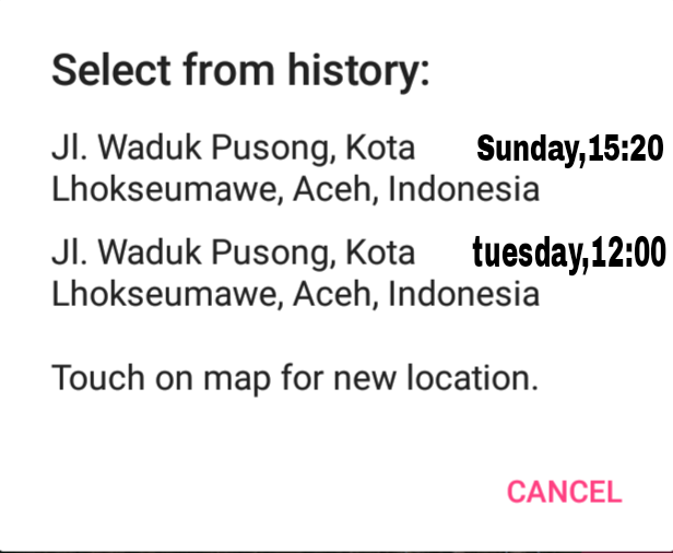 I mean a feature like this,complete the detail about the location.
Component Fake traveler is an app to falsify location of device.decent for personal necessity or other purposes like a test or an experiment in routine days.user guide only Clicking or long press on a location map and afterwards press on apply button and your locality has been mocking or switch over. And before mock the location,a user have to access to developer option which in settings android.in analysis there are two usability of this app.first for development and second for cheating.we can see in development greatly helpful for reproducing system surroundings without leaving the home for example we have some error on the route in GPS log,when refinement we only run the log then the app acting up like it was travelling on distinctive road. And on section cheating visible usefulness when playing a game like POKEMON or others,we forge our location to gain something we incapable to.
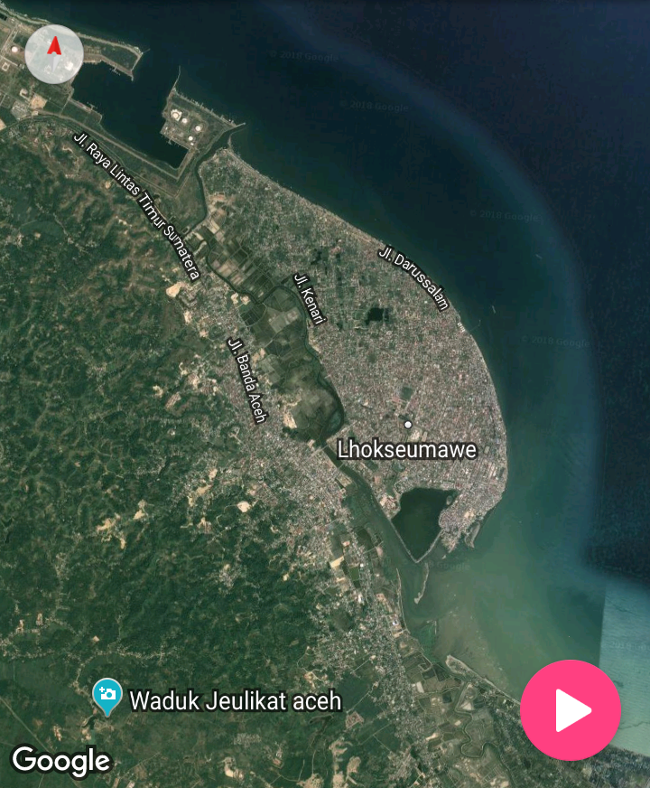
Proposal. Since using the app in recent time,evidently so practical to use on mocking GPS system,Only several feature is incomplete and I as a client want to distribute some of my idea to enhance or complement the quality of the app,as a PO might want his project more exquisite. My proposal is following below. 1.fake in satellite 2.notification 3.forgery history Fake in Satellite is a component that be required in fake or mocking map which will give anyone to mocking location in a visual nature object in space, beginning from continent to a country,county and area or organization,the satellite will collecting any information of the map.and with 2d image we can see every part of the world. Notification is a safety feature which give caution to a user in case something happens or going on.for example in the feature will notify train schedules or circumstances of traffic on the route that we pass frequently,Traffic conditions in a place are difficult to predict, can change suddenly in hours or in minutes. forgery history is a feature which display all the activity of fake location that has been used,will showed every detail of place like when the time we mocking location or the spot(point)of place we mocking.
Mock up I've been design fake in setellite will be placed in angle of main map.we can see the object clearly.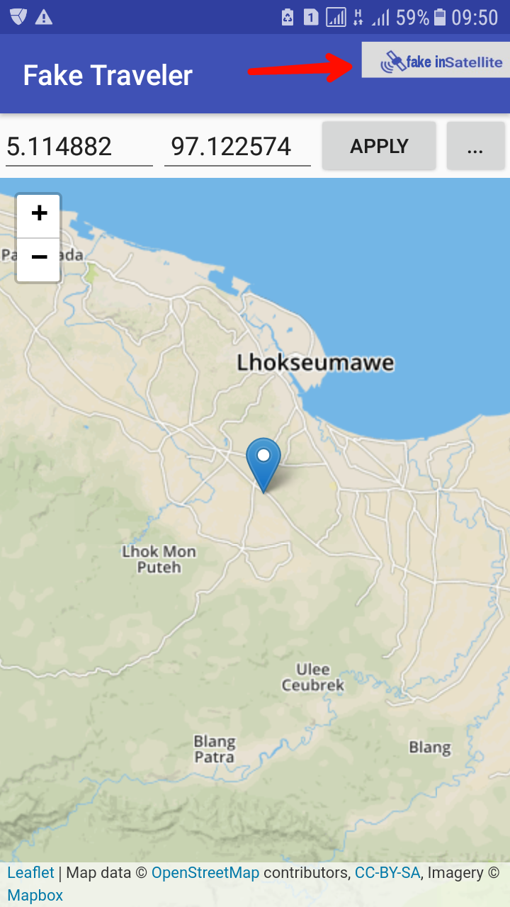 This is how working.
Notification looks goodly be placed in under''time interval in seconds between every mock''and neatly arranged with the others.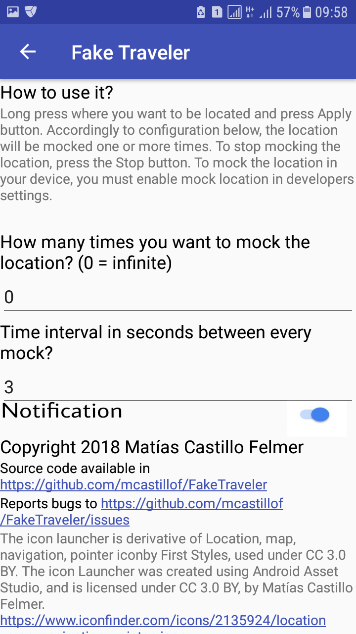
Forgery history will be affix under notification feature.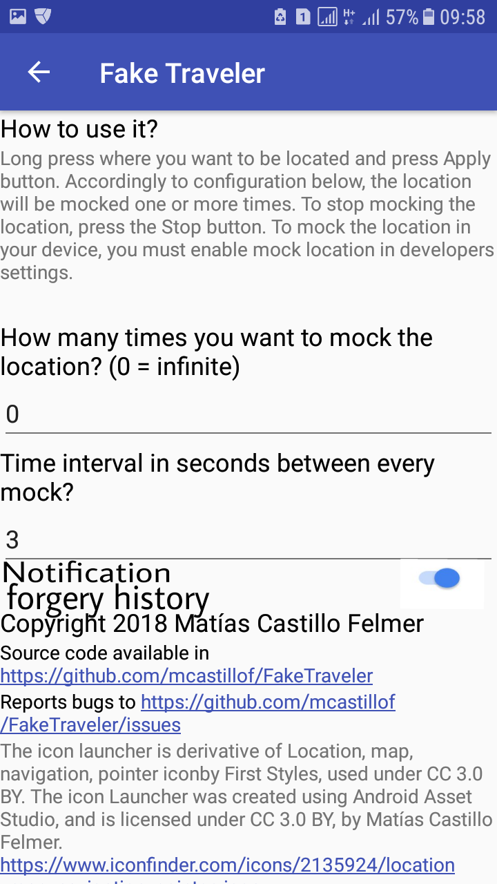
Benefits. I've been gather and accumulate all my analysis that features I recommend very useful for PO.the following is usefulness of feature
1.fake in satellite With affix fake in satellite it will give a natural visual for user and in utilization the satellite will clarify an existing object in the map even we zoom to closest distance,I thought this is very good idea in mocking or fake our location,we can put our position in a gap or in a small object like a tree, on a sidewalk or other.
2.notification when we mocking or fake our position in an area like in traffic on the street, notification will notify us about all details in that position for example traffic is on jams or about plan road closures that can affect the traffic.this allows us to choose the right way(road) to take our destination .in another side with notification we will receive info that in a nearby there's taxi service, so can help to a trip so quick to get aim.this a great argument for this feature is very useful in application.
3.forgery history Forgery history will display all information about our fake location history.with all of data covered by GPS,usability of this feature is users could re-select the position or place that they have been mocking in the past so not hardship to find a spot of area in future,this will simplify for client. these three features are has great valuable for the application,I wish the PO Would be pleasure to affix these.