 qgib
commented
6 years ago
qgib
commented
6 years ago Author Name: Jürgen Fischer (@jef-n)
- description was changed from After yesterday's file corruption debacle, I'm trying to make backups of complex creations.
Right-clicked a layer XSCutLines, Export -> Save Features As... (with load to map checked)
After Exporting a copy to shapefile...
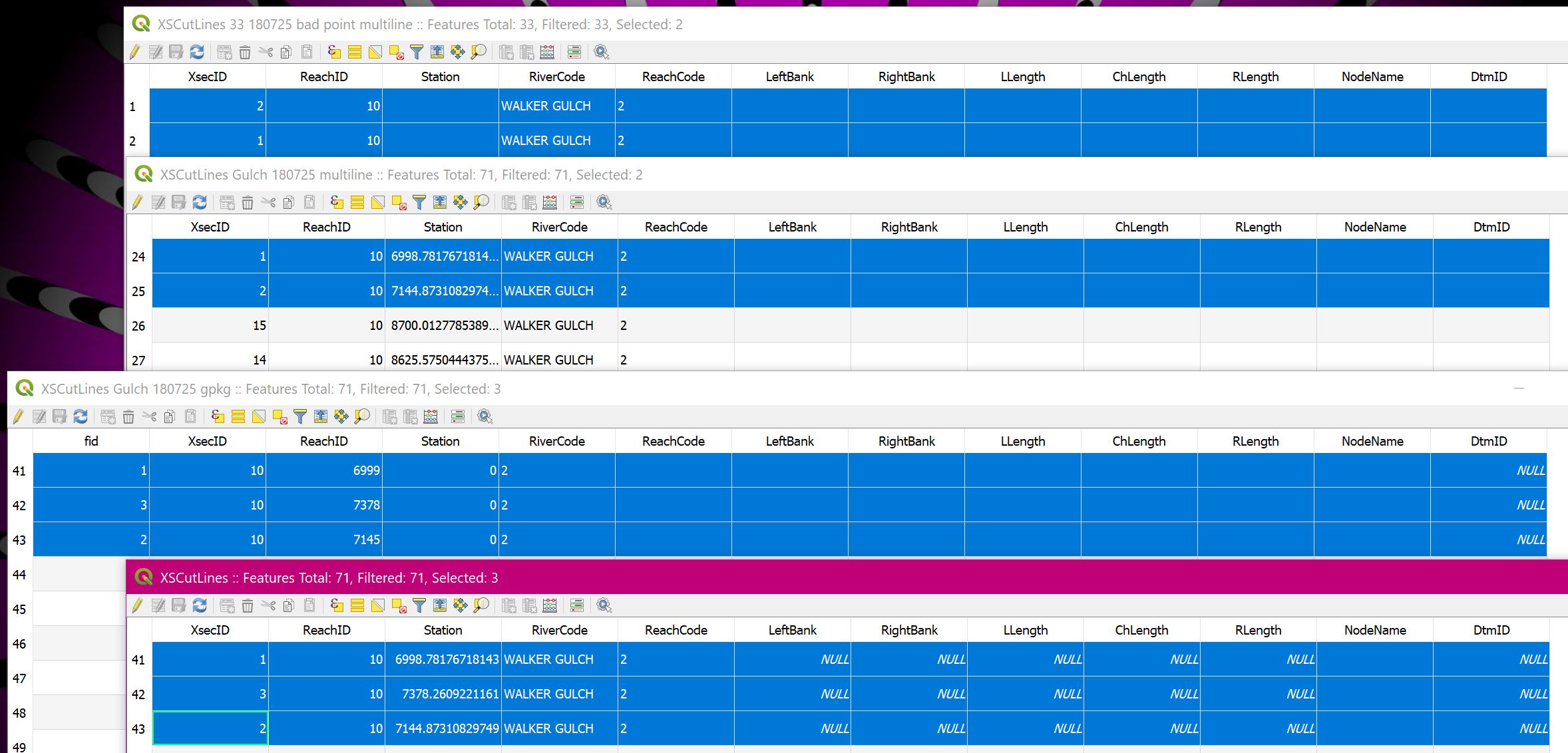
Attribute Table data looked good:
wkt_geom XsecID ReachID Station RiverCode ReachCode LeftBank RightBank LLength ChLength RLength NodeName DtmID
MultiLineString ((6186583.15544720087200403 2243164.85563876014202833, 6186209.05874442309141159 2243863.58171171601861715)) 69 10 4253.06211053154 WALKER GULCH 2
...
Attribute Tables and data match, copy and original, include stationing Original draws stationing Copy draws nothing onscreen, despite showing 71 items
Removed layer and reloaded from shapefile, it shows zero items, but now draws properly But mousing over its layer name shows the original RiverGIS PostGIS table as source, not the shapefile!
Removed again, and now nothing happens when trying every route to Add it back...
Saved project, closed and restarted QGIS Still won't load saved file
--> It saved only XSCutLines Gulch 180725 OK.shp and .dbf, not all six files!
Layer -> SaveAs again, same dialog, same filename, this time it saved six files Now it can be Added or drug into QGIS, shows shapefile as source and it draws the lines, but not the station numbers Numbers are clearly in the table...
Maybe there is some detail in the PostGIS db that doesn't export to a shapefile? Database -> DB Manager -> Table -> Export to vector file -> GeoPackage Seemed to work, could load it, lines but no station numbers drawn
Is there some way to make backup copies of PostGIS tables? I'm not finding anything even in DB Manager...
Maybe the RiverGIS plugin is actively drawing those station numbers for the files it remembers it wrote? I'd assumed it was only active when I asked it to do something. Its interface isn't even open now, and the numbers are still drawn for the file it made.
How can I get a backup of that file that works like the original? (See [[https://issues.qgis.org/issues/19489]] for the reason I'm paranoid...) to After yesterday's file corruption debacle, I'm trying to make backups of complex creations.
Right-clicked a layer XSCutLines, Export -> Save Features As… (with load to map checked)
After Exporting a copy to shapefile…
Attribute Table data looked good:
wkt_geom    XsecID  ReachID Station RiverCode   ReachCode   LeftBank    RightBank   LLength ChLength    RLength NodeName    DtmID
MultiLineString ((6186583.15544720087200403 2243164.85563876014202833, 6186209.05874442309141159 2243863.58171171601861715))    69  10  4253.06211053154    WALKER GULCH    2
…
Attribute Tables and data match, copy and original, include stationing Original draws stationing Copy draws nothing onscreen, despite showing 71 items
Removed layer and reloaded from shapefile, it shows zero items, but now draws properly But mousing over its layer name shows the original RiverGIS PostGIS table as source, not the shapefile!
Removed again, and now nothing happens when trying every route to Add it back…
Saved project, closed and restarted QGIS Still won't load saved file
--> It saved only XSCutLines Gulch 180725 OK.shp and .dbf, not all six files!
Layer -> SaveAs again, same dialog, same filename, this time it saved six files Now it can be Added or drug into QGIS, shows shapefile as source and it draws the lines, but not the station numbers Numbers are clearly in the table…
Maybe there is some detail in the PostGIS db that doesn't export to a shapefile? Database -> DB Manager -> Table -> Export to vector file -> GeoPackage Seemed to work, could load it, lines but no station numbers drawn
Is there some way to make backup copies of PostGIS tables? I'm not finding anything even in DB Manager…
Maybe the RiverGIS plugin is actively drawing those station numbers for the files it remembers it wrote? I'd assumed it was only active when I asked it to do something. Its interface isn't even open now, and the numbers are still drawn for the file it made.
How can I get a backup of that file that works like the original? (See #27317 for the reason I'm paranoid…)
Author Name: Loren Amelang (@LorenAmelang) Original Redmine Issue: 19490 Affected QGIS version: 3.2 Redmine category:project_loading/saving
After yesterday's file corruption debacle, I'm trying to make backups of complex creations.
Right-clicked a layer XSCutLines, Export -> Save Features As... (with load to map checked)
After Exporting a copy to shapefile...
Attribute Table data looked good:
wkt_geom XsecID ReachID Station RiverCode ReachCode LeftBank RightBank LLength ChLength RLength NodeName DtmID MultiLineString ((6186583.15544720087200403 2243164.85563876014202833, 6186209.05874442309141159 2243863.58171171601861715)) 69 10 4253.06211053154 WALKER GULCH 2
...
Attribute Tables and data match, copy and original, include stationing Original draws stationing Copy draws nothing onscreen, despite showing 71 items
Removed layer and reloaded from shapefile, it shows zero items, but now draws properly But mousing over its layer name shows the original RiverGIS PostGIS table as source, not the shapefile!
Removed again, and now nothing happens when trying every route to Add it back...
Saved project, closed and restarted QGIS Still won't load saved file
--> It saved only XSCutLines Gulch 180725 OK.shp and .dbf, not all six files!
Layer -> SaveAs again, same dialog, same filename, this time it saved six files Now it can be Added or drug into QGIS, shows shapefile as source and it draws the lines, but not the station numbers Numbers are clearly in the table...
Maybe there is some detail in the PostGIS db that doesn't export to a shapefile? Database -> DB Manager -> Table -> Export to vector file -> GeoPackage Seemed to work, could load it, lines but no station numbers drawn
Is there some way to make backup copies of PostGIS tables? I'm not finding anything even in DB Manager...
Maybe the RiverGIS plugin is actively drawing those station numbers for the files it remembers it wrote? I'd assumed it was only active when I asked it to do something. Its interface isn't even open now, and the numbers are still drawn for the file it made.
How can I get a backup of that file that works like the original? (See #27317 for the reason I'm paranoid...)