 samapriya
commented
3 years ago
samapriya
commented
3 years ago Hi @deepix This has now been added and available here
https://samapriya.github.io/awesome-gee-community-datasets/projects/global_irrigation/
Thank you for contributing to the community datasets
Dataset Name
Global irrigation areas from 2001 to 2015.
License: Creative Commons Attribution 4.0 International License
Citation:
Deepak Nagaraj, Eleanor Proust, Alberto Todeschini, Maria Cristina Rulli, Paolo D'Odorico, A new dataset of global irrigation areas from 2001 to 2015, Advances in Water Resources, Volume 152, 2021, 103910, ISSN 0309-1708, https://doi.org/10.1016/j.advwatres.2021.103910. (https://www.sciencedirect.com/science/article/pii/S0309170821000658)
Abstract: About 40% of global crop production takes place on irrigated land, which accounts for approximately 20% of the global farmland. The great majority of freshwater consumption by human societies is associated with irrigation, which contributes to a major modification of the global water cycle by enhancing evapotranspiration and reducing surface and groundwater runoff. In many regions of the world irrigation contributes to streamflow and groundwater depletion, soil salinization, cooler microclimate conditions, and altered land-atmosphere interactions. Despite the important role played by irrigation in food security, water cycle, soil productivity, and near-surface atmospheric conditions, its global extent remains poorly quantified. To date global maps of irrigated land are often based on estimates from circa year 2000. Here we apply artificial intelligence methods based on machine learning algorithms to satellite remote sensing and monthly climate data to map the spatial extent of irrigated areas between 2001 and 2015. We provide global annual maps of irrigated land at ≈9km resolution for the 2001-2015 and we make this dataset available online.
Keywords: Irrigation; Global irrigated areas; Irrigation maps; Machine learning
Snapshot: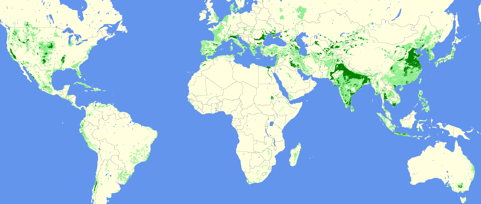
Earth Engine Snippet
You can also get maps for individual years as TIF images:
Sample code
Band Info: Irrigation classes are present in the band "classification"
0 = no or very little irrigation 1 = low-to-medium irrigation (<= 2000 hectares in 86 sq km square of land) 2 = high irrigation (>2000 hectares in 86 sq km square of land)
Required
License Information: Creative Commons Attribution 4.0 International License
Curated by: Deepak Nagaraj
Keywords: Global irrigation, agriculture, water sustainability, machine learning
Last updated: 2020-06-10