 westnordost
commented
1 year ago
westnordost
commented
1 year ago Regarding the coloring, I've been doing some research and thinking about which maxspeed values could/should be grouped together. Though, the color suggestions are probably not color-blind-friendly.
| % of maxspeed values | maxspeed value | suggested color |
|---|---|---|
| 1% | 130 | violet |
| 1% | 120 | blue |
| 1% | 110 | blue |
| 3% | 100 | teal |
| 3% | 90 | teal |
| 6% | 80 | green |
| 5% | 70 | green |
| 8% | 60 | chartreuse |
| 27% | 50 | yellow |
| 9% | 40 | yellow |
| 22% | 30 | amber |
| 3% | 20 | orange |
| 1% | 10 | orange |
 riQQ
riQQ letypequividelespoubelles
 matkoniecz
 joshinils
 tszym
tszym arrival-spring
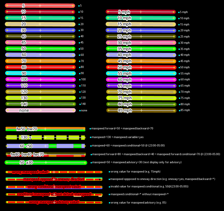
 RubenKelevra
 NathanARF
 michaelblyons
Use case IMHO it would be a very usefull overlay, as maxspeed isn't a resurveyable quest, and not so easy to map and correct (no opendata for it in France, no easy editors to do it in situ).
Proposed Solution As UX, I might proposed that highway are in a specific color (red ?) if there are no maxspeed tag. If a mawspeed is already tagged, put a sign (in a form of a traffic sign) to tell what's already tagged :
When clicking on a highway to add/modify the speed limit, the same UX as for the maxspeed quest would be perfect.
Thanks !