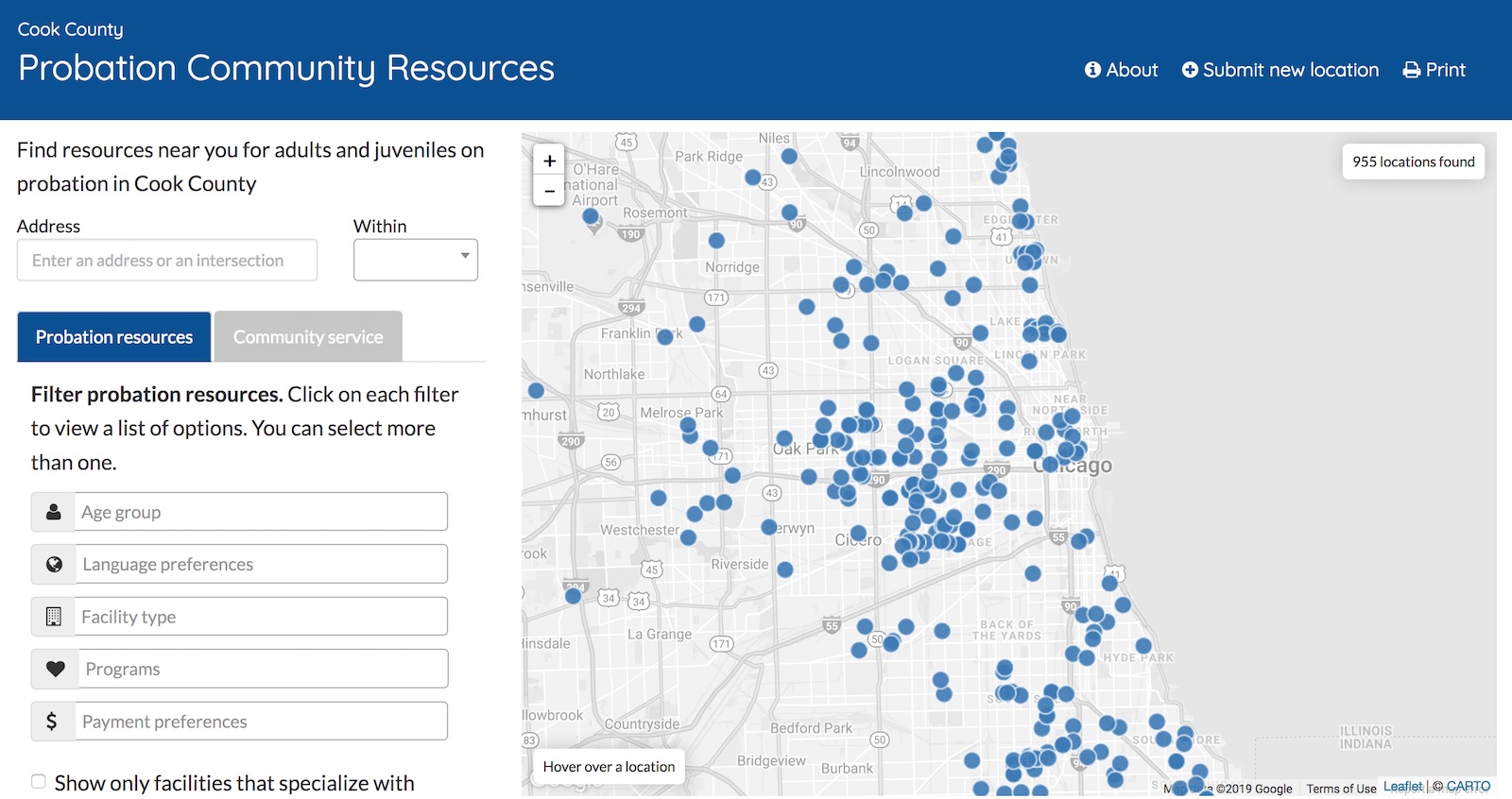
Probation Community Resources
Probation Community Resources is an online interactive, searchable map that helps users:
- find social, health, and cultural resources throughout Chicago
- identify services within certain geographic boundaries
- suggest updates, changes, and additions to the directory
Built in collaboration with the Cook County Adult Probation Department (CCAPD), the Cook County Juvenile Probation Department (CCJPD), the Sargent Shriver National Center on Poverty Law, the Chicago Appleseed Fund, and the Health & Medicine Policy Research Group, Probation Community Resources helps criminal justice personnel refer clients to culturally relevant and geographically specific community-based services.

Installation
  $ git clone https://github.com/datamade/probation-resources-map.git
  $ cd site_template
  $ gem install jekyll
  $ jekyll serve -w
  navigate to http://localhost:5000/
Data updates
The data for this site is housed a Google Spreadsheet and synced with CARTO. Initially, it was set up to automatically update every 30 minutes, but the automatic import for CARTO failed on parsing the spreadsheet properly. Now, to do updates, you must take the following steps:
- Download a CSV of the
Probation Resources MapGoogle Sheet: https://docs.google.com/spreadsheets/d/1iShheCZRamOmuWo3SETgbWopHCCu1DRB_F5_FZMKp5A/edit#. This ensures only the sheet with the info we want is included (CARTO gets confused by Excel files with multiple sheets) - In Excel or LibreOffice, save the CSV as an XLSX file.
- In CARTO, create a new dataset and make sure the "Let CARTO automatically guess data types and content on import." box is UNCHECKED (if it is, CARTO will convert fields like Yes/No into boolean true/false)
- After the table is created, go to Edit => Georeference and select the latitude and longitude columns to set as the location.
- Set the table to visible With link
- Click visualize to create a map visualization layer
- Click Publish and copy the visualization layer URL under CartoDB.js (should be something like
https://datamade.carto.com/api/v2/viz/b9ab99de-e4e7-4625-9dc5-032097853133/viz.json) and updatelayerUrlincartodb_lib.js. - Copy the table name (found by clicking on the SQL icon on the right) and update
tableNameincartodb_lib.js - Preview the site and make sure there are no javascript errors and the points display as expected. If the map doesn't display, open up the Network tab to diagnose errors from CARTO. It won't throw javascript errors, but the network responses from their domain will tell you the error it encountered. It is typically due to column names being slightly changed or renamed.
Dependencies
Data
The data for this tool resides in a Google spreadsheet and its corresponding Carto table.
Most of the data has been (and continues to be) manually entered by people associated with CCAPD, CCJPD, the Shriver Center, the Appleseed Fund, and the HMPR Group. One data piece can be automated: the discovery of latitude and longitude for facility addresses. We use Google Sheets Geocoder - specifically, geocoder-census-google.gs - a library that converts addresses into lat-long coordinates.
Run Tests
This site includes a basic test suite built with Rspec and Capybara, which drive the browser to perform acceptance tests.
  $ bundle install
  $ rspec spec/
Some tests include binding.pry. In such cases the test pauses, after which you may type "exit" in the terminal to continue.
Team
Errors / Bugs
If something is not behaving intuitively, it is a bug, and should be reported. Report it here: https://github.com/datamade/probation-resources-map/issues
Note on Patches/Pull Requests
- Fork the project.
- Make your feature addition or bug fix.
- Commit, do not mess with rakefile, version, or history.
- Send a pull request. Bonus points for topic branches.
Copyright
Copyright (c) 2022 DataMade. Released under the MIT License.