Navit 


A copylefted libre software car-navigation system with its own routing engine.
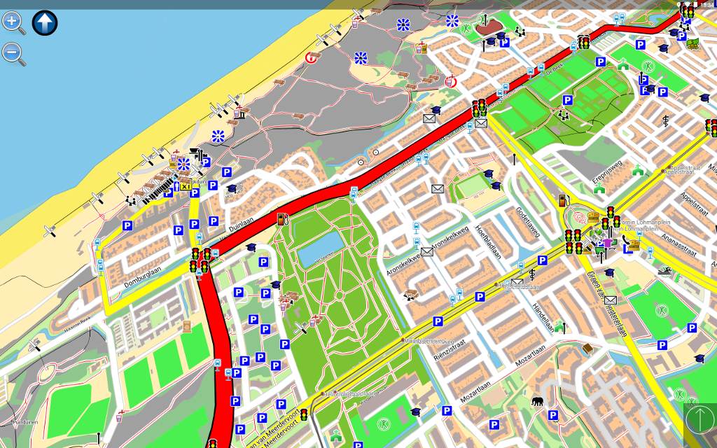
On an Android tablet \
 \
On a Linux-based carputer \
\
On a Linux-based carputer \
 \
<img src="https://fdroid.gitlab.io/artwork/badge/get-it-on.png"
alt="Get it on F-Droid"
height="130">
<img src="https://play.google.com/intl/en_us/badges/images/generic/en-play-badge.png"
alt="Get it on Google Play"
height="130"> \
Modular design with routing and rendering of one or more vector maps in various formats. \
GTK and SDL user-interfaces with touch-screen displays. \
Current vehicle position from gpsd or directly from NMEA (GPS) sensors. \
Optimal routes and directions spoken in 70+ languages. \
Points of interest (POIs) in many formats.
\
<img src="https://fdroid.gitlab.io/artwork/badge/get-it-on.png"
alt="Get it on F-Droid"
height="130">
<img src="https://play.google.com/intl/en_us/badges/images/generic/en-play-badge.png"
alt="Get it on Google Play"
height="130"> \
Modular design with routing and rendering of one or more vector maps in various formats. \
GTK and SDL user-interfaces with touch-screen displays. \
Current vehicle position from gpsd or directly from NMEA (GPS) sensors. \
Optimal routes and directions spoken in 70+ languages. \
Points of interest (POIs) in many formats.
Help and more info available on the wiki. \ The Reporting Bugs document helps you file issues.
Maps
OpenStreetMap — display, routing, incomplete street-name search. \ Grosser Reiseplaner and compliant maps — full support. \ Garmin maps —display, routing, search is being worked on.
GPS Support
Current vehicle position from \ — a file or port. \ — gpsd (local or remote). \ — the location service of several mobile platforms. \ — a UDP server (friends tracking) (experimental).
Translation
The Hosted Weblate platform is used to manage translations, which runs Weblate.

Routing algorithm
Uses LPA* starting at the destination by assigning \ a value to each point directly connected to the destination point. \ It represents estimated time needed to reach the destination from that point. \ A Fibonacci-heap search for the point with the lowest value (to find \ a value then assigned to connected points either unevaluated or whose \ current value is greater than the new one) is repeated until the origin is found. \ Once reaching the origin, the lowest-value points are followed to the destination.
the (experimental) traffic module re-evaluates route-graph portions as segment costs change. \ It can process traffic reports and find a way around problems.