pyAirwaves, realtime planes and boats display on map with rtl-sdr

![]()
![]()
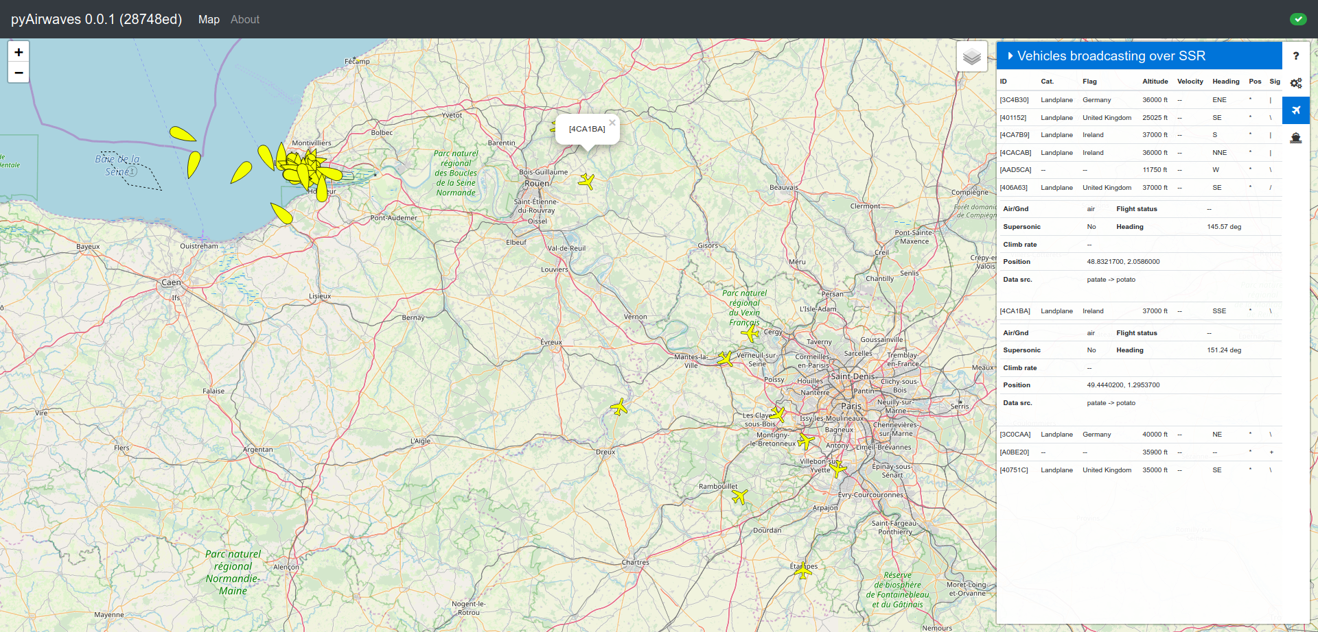
Screenshot
Licensing
This project is licensed under AGPL v3, except a few files in js and css which are GPL v3 from AirSuck project.
See LICENSE.other file.
What is it
This project use the AirSuck frontend with new features, improvements and uses Leaflets maps.
The entire backend haven't been kept and then entirely write from scratch.
pyAirwaves will use dump1090 and rtl-ais daemons to send real-time display of airplanes and boards to a maps for display.
Some more features will be available like airplane picture, company, and statistics.
Requirements
- redis server
- postgresql >= 10 (should work with lower but you are on your own)
- python >= 3.6
- elixir >= 1.5
- at least 5G of disk space on the server running nginx (tile caching)
- an ADSB source (dump1090)
- an AIS source (rtl-ais)
Setup
See docs/install.md
Daemons/scripts:
airwaves_adsb_client.pywill connect to dump1090airwaves_ais_client.pywill connect to rtl-aissimulator_adsb_real_datas.pyinstead of connecting to a remote dump1090, it will replay 15minutes of ADS-B datassimulator_adsb_coordinates.pyinstead of connecting to a remote dump1090, it will replay three planes looping somewhere in the USAsimulator_ais_real_datas.pyinstead of connecting to a remote rtl-ais, it will replay a few minutes of AIS datasinstallation/*.servicesystemd services files for the daemons and production server
Docs
Various docs can be found in the docs/ folder.
Contact
Dashie dashie@sigpipe.me