![]()

![]()


Urbanity
Urbanity is a network-based Python package developed at the NUS Urban Analytics Lab to automate the construction of feature rich (contextual and semantic) urban networks at any geographical scale. Through an accessible and simple to use interface, users can request heterogeneous urban information such as street view imagery, building morphology, population (including sub-group), and points of interest for target areas of interest.
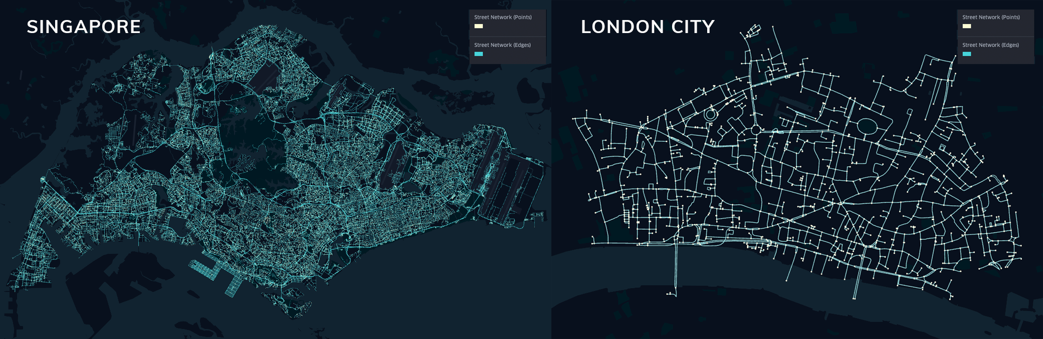
Network of cities around the world
Features
- Rapid city-scale network generation
- Seamless computation of metric, topological, contextual, and semantic network indicators
- Node and edge spatial context computation
- Areal statistics for arbitrary urban subzones
- Validity checks for OpenStreetMap attribute completeness (no. of buildings, percentage with height, percentage with levels, etc.)
- Primal planar, dual, and spatial graph generation
Designed for urban planners
Urbanity is designed in an object-oriented approach that parallels the urban planning process. The urban data science pipeline starts with a base map which users can use to explore their site. Subsequently, there are two ways to specify geographical area of interest: 1) drawing with the polygon and box tools provided; or 2) providing your own polygon shapefiles (all common formats .shp/.geojson are supported).
Towards exploring complexities underlying urban systems and facilitating comparative study between cities, Urbanity is developed to facilitate downstream descriptive, modelling, and predictive urban analytical tasks.
Quickstart
How do I install Urbanity?
Urbanity is built on several geospatial packages (e.g., GeoPandas, ipyleaflet, rasterio, etc.,) that are best compiled through conda-forge. For seamless installation, we provide an environment.yml file for users to create their own conda environment. Please follow the steps below to ensure proper installation:
1) Navigate to a location of choice (e.g., Desktop or project folder). 2) Download environment.yml file and place it at the location of choice (Step 1). 3) Open up a terminal/command prompt and input the following command:
$ conda config --set channel_priority strict
$ conda env create -f environment.yml
$ conda activate urbanity
4) Installation completed and you should be able to use urbanity without issues.
(Optional) For JupyterLab / JupyterNotebook users, you can additionally add a notebook kernel via:
$ python -m ipykernel install --user --name=urbanity
$ jupyter lab
What can I do with Urbanity?
We demonstrate how you can conduct a diverse range of urban analytical tasks (such as graph machine learning, network assortativity analysis, and benchmarking across cities) with Urbanity. Check out the documentation and examples/tutorials in the documentation site examples.
Sample dataset and notebooks to follow examples can be accessed at this repository.
Citation
If you use Urbanity in your work, please cite:
Yap, W., Stouffs, R. & Biljecki, F. Urbanity: automated modelling and analysis of multidimensional networks in cities. npj Urban Sustain 3, 45 (2023). https://doi.org/10.1038/s42949-023-00125-w
Yap, W., Biljecki, F. A Global Feature-Rich Network Dataset of Cities and Dashboard for Comprehensive Urban Analyses. Sci Data 10, 667 (2023). https://doi.org/10.1038/s41597-023-02578-1
License
urbanity was created by winstonyym. It is licensed under the terms of the MIT license.
Credits
- Logo design: April Zhu
- Colab notebooks: Kunihiko Fujiwara
- OSMnx Github
- Geopandas Github
- Pyrosm Github
- NetworkX Github
- ipyleaflet Github