Behavior and Path Planning


In this project, the goal is to safely navigate around a virtual highway with other vehicles that are driving +-10 MPH of the 50 MPH speed limit. You will be provided the car's localization and sensor fusion data, there is also a sparse map list of waypoints around the highway. The car should try to go as close as possible to the 50 MPH speed limit, which means passing slower traffic when possible, note that other cars will try to change lanes too. The car should avoid hitting other cars at all cost as well as driving inside of the marked road lanes at all times, unless going from one lane to another. The car should be able to make one complete loop around the 6946 m highway. Since the car is trying to go 50 MPH, it should take a little over 5 minutes to complete 1 loop. Also the car should not experience total acceleration over 10 m/s^2 and jerk over 10 m/s^3.
Dependencies
- uWebSockets 0.14.8
- Eigen3 3.3.7
Download
$ git clone https://github.com/zhujun98/behavior-and-path-planning.gitUpdate submodules (Eigen3)
$ git submodule init
$ git submodule update
Build, install and run
-
Download the simulator
-
Install uWebSockets
$ ./scripts/install_uWS_ubuntu.sh
With CMake
$ mkdir build && cd build
$ cmake .. && make -j4
$ cd apps
$ ./run_app MAP_FILE # the default MAP_FILE is "data/highway_map.csv"
To use boost.log in this project:
$ ./scripts/install_boost.sh
$ mkdir build && cd build
$ cmake -DWITH_BOOST .. && make -j4
To build and run the test:
$ mkdir build && cd build
$ cmake -DBUILD_TESTS .. && make -j4
$ make unittest
With Bazel
Install Bazel following the official instruction and then type
$ bazel build ...
$ bazel run apps:run_app MAP_FILE
Highway map
The map data of the highway is listed in highway_map.csv. Each row of the data contains [x, y, s, dx, dy] values for a waypoint, where x and y are the coordinates in the global coordinate system, s is the longitudinal coordinate along the reference trajectory, dx and dy define the x and y components of the unit vector d which is normal (pointing to the right of the traffic direction) to the reference trajectory.

Simulator output
-
Localization data (without noise)
- ["x"] x in the Cartesian coordinate system, m
- ["y"] y in the Cartesian coordinate system, m
- ["s"] s in the Frenet coordinate system, m
- ["d"] d in the Frenet coordinate system, m
- ["yaw"] yaw angle, degree
- ["speed"] speed, MPH
-
Sensor fusion data (without noise)
- ["sensor_fusion"] A list other cars' data on the same side of the road in the format [[ID, x (m), y (m), vx (m/s), vy (m/s), s (m), d (m)]]
-
Unprocessed previous path data passed to the simulator (not used)
- ["previous_path_x"] lists of unprocessed x coordinates, m
- ["previous_path_y"] lists of unprocessed y coordinates, m
-
End point of the previous path (not used)
- ["end_path_s"] s in the Frenet coordinate system, m
- ["end_path_d"] d in the Frenet coordinate system, m
Behavior planning
Behavior planning is achieved by using the FSM pattern:
Start Up -> Keep Lane <-> Change Lane
Path planning
The following strategy is applied in searching the optimized path:
- Estimate the feasible final dynamics (s, d, speed, etc.) of the car in a given state;
- Greedily search the jerk minimizing trajectories which takes the shortest time and has the shortest distance;
- Collision check is applied in the Change Lane state. If a collision could happen for the planned path, the car will keep going in the current lane. If a valid path can not be found after a certain time, it will switch back to the Keep Lane state.
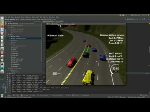
Videos (to be updated...)
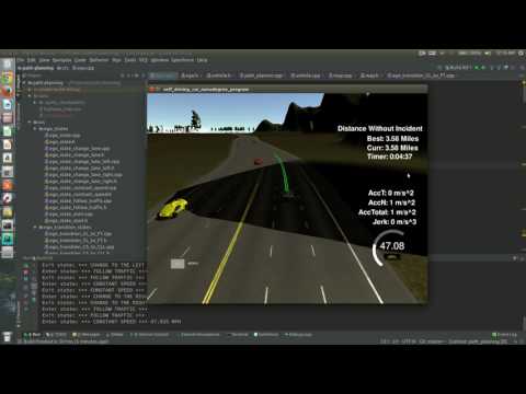
Increase the speed to 85 MPH. More exciting!