-
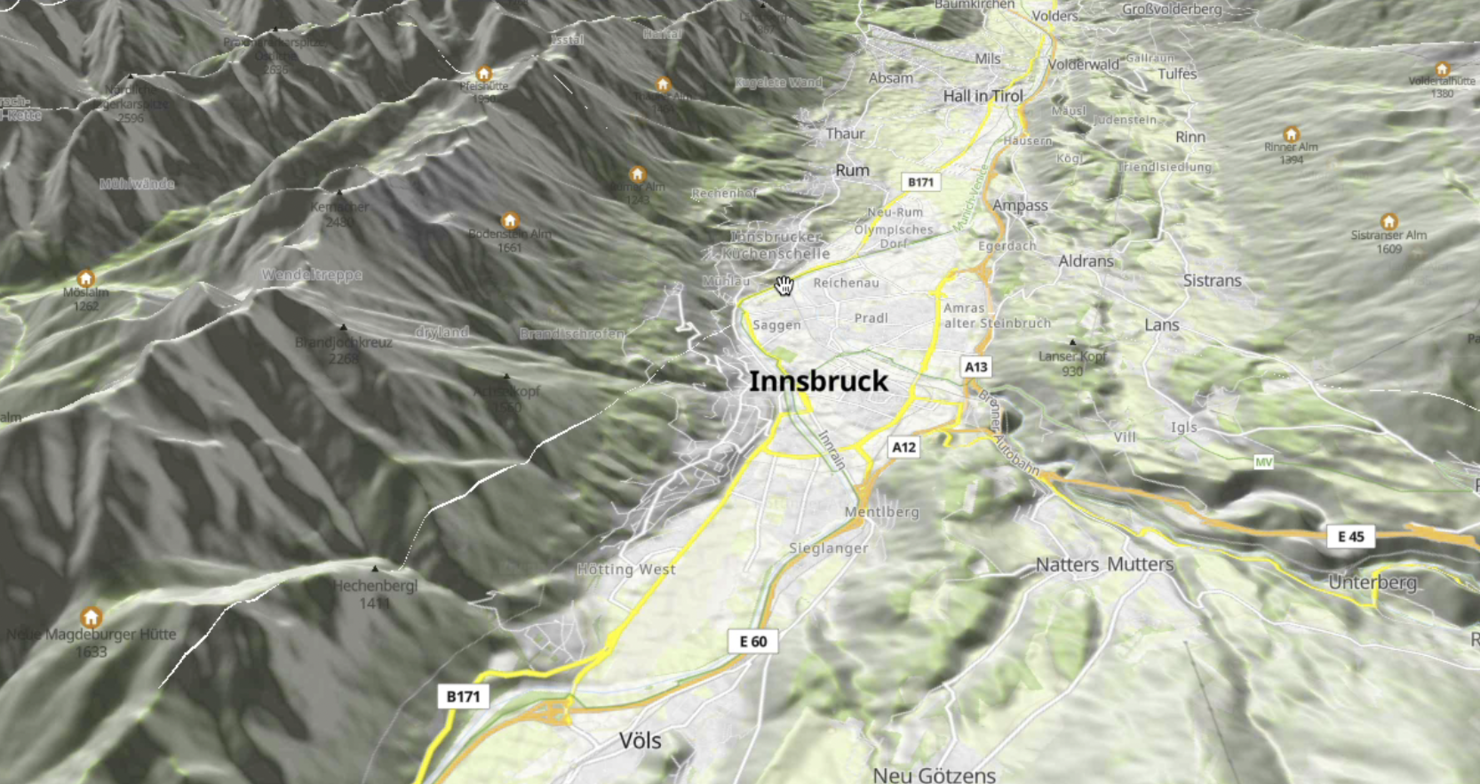
Include an option to graphically display the returned elevation files as either a 3D render plot or as a heatmap. The following is an example visualisation.
![screenshot-docs google com-2021 08 1…
-
Compared to the flat 2D display now, some nice, isometric 2D might be looking much better without needing to go to full 3D. Look at some other open source games how they do it and make it similar. For…
-
We need a profile view to visualize the terrain and how the autopilot will respond to it while utilizing Terrain Following. The Elevation Graph does not show the aircraft following the terrain. There …
-
Hello!
We're working on a game that has terrain and physics objects. We're using `TriMesh` for representing that terrain currently. We have been having issues with objects falling through the terra…
-
The Terrain Profile Chart is an update to the view at the bottom of the Plan View accessed by clicking the "T" button if you have it hidden. The current state of this new feature is that it will take …
-
![image](https://user-images.githubusercontent.com/53421382/215048047-e5bb6836-2c23-4a2b-b5af-4af28135472c.png)
Tracking issue for the cross-platform Bounty Direction on Terrain3D. Individual Bou…
-
**Is your feature request related to a problem? Please describe.**
Right now it is not possible to navigate through the 3D representation in the Esmini Viewer plugin. The coordinates are fixed to the…
-
## Describe the issue
The Terrain Developer Guide documentation is likely to exist before the Engine Developer Guide RFC ( https://github.com/o3de/sig-docs-community/pull/73/files ) is approved and…
-
# Design Goals
* Use the same terrain data across all devices in the ecosystem
* Autopilot (PX4, ArduPilot, Etc)
* Companion Computer (grid_map_geo) or other computers running ROS 2
* Grou…
-
### Describe the bug
When training with rsl_rl in the default locomotion/velocity environments, if you switch the viewer origin type to track the asset_root the terrain is not visualized when recor…